
Home - Search - Browse - Alphabetic Index: 0- 1- 2- 3- 4- 5- 6- 7- 8- 9
A- B- C- D- E- F- G- H- I- J- K- L- M- N- O- P- Q- R- S- T- U- V- W- X- Y- Z
Navstar
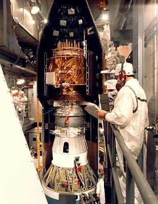 GPS IIA in assembly Credit: Hughes |
AKA: GPS.
By 2000 civilian users greatly outnumbered military users, and the trend increased year-by-year. The very similar Russian GLONASS system used similar frequencies and single receivers could be built to handle signals from both satellites. Concerns about the US control over a system that came to be essential to civilian and military users worldwide led Europe to begin development of their own independent Galileo system in 2002.
GPS is managed by an Interagency GPS Executive Board. The US Air Force is designated as the executive service for system management. The system is operated and controlled by the 50th Space Wing's (Air Force Space Command) 2nd Space Operations Squadron, Schriever Air Force Base, Colorado. The Space and Missile Systems Center's (Air Force Space Command) Navstar GPS Joint Program Office, Los Angeles Air Force Base, California, is the DoD agency for acquiring GPS satellites, ground systems and military user equipment.
Delta II expendable launch vehicles are used to launch the GPS satellites from Cape Canaveral Air Station, FL, into six planes of circular 20,200 km / 12-hour orbits .
GPS provides the following:
- 24-hour, worldwide service
- Extremely accurate, three-dimensional location information (providing latitude, longitude, and altitude readings)
- Extremely accurate velocity information
- Precise timing services
- A worldwide common grid that is easily converted to any local grid
- Continuous real-time information
- Accessibility to an unlimited number of worldwide users
- Civilian user support at a slightly less accurate level
The signals are so accurate that time can be figured to within 100 nanoseconds, velocity can be figured to within a fraction of a km per hour, and location can be figured to within meters.
GPS satellites orbit the earth every 12 hours emitting continuous navigation signals on two different L-band frequencies, L1 and L2.
Fundamental research on timing and navigation technology for Navstar was conducted by the Timation satellite series in the 1960's. There followed four generations of GPS satellites: the Block I, the Block IIA, the Block IIR, and the Block IIF. Block I satellites were used to test the principles of the Global Positioning System, and lessons learned from these 11 satellites were incorporated into later blocks. Block II, IIA and IIR satellites made up the constellation by the turn of the century. A total of 28 II/IIAs were put on contract, with the last four tagged as replacements for earlier satellites reaching the end of their service life. Block IIRs replaced older Block II/IIAs as they wear out. Block IIF fourth generation satellites were planned to begin flying in 2005.
The Joint Program Office Advanced Plans Branch is actively studying the opportunity to improve accuracy, availability, integrity, and survivability to meet emerging military and civil needs through 2030. The next block of satellites, called GPS III, would continue to deliver the new civil signals and improved military codes that were initiated on the GPS IIR-M and IIF programs. The first launch of research and development GPS III satellites was not expected before 2010.
Navstar continues to perform as the world's premier positioning and navigation systems. Endeavors such as mapping, aerial refueling, rendezvous operations, geodetic surveying, and search and rescue operations have all benefited greatly from GPS's accuracy.
Using lessons learned from Operations Desert Shield and Desert Storm, GPS User Equipment is being integrated into nearly all facets of modern warfare. Forward air controllers, pilots, tank drivers, and ground troops all use GPS to help ensure victory on the battlefield. GPS User Equipment consists of the receivers that use the signal from GPS satellites to compute position, time, and velocity primarily for military users. GPS receivers are integrated into every type of system used by the DoD: aircraft, spacecraft, munitions, ground vehicles and ships.
Stand-alone, hand-held receivers for individual use are also widespread among all branches of the Department. These receivers provide real-time situational awareness for the warfighter much more quickly and accurately than previous, conventional methods. GPS-guided munitions showcase this increased capability and are delivered with unprecedented accuracy, thus improving crew survivability while decreasing the number of weapons required to achieve military objectives.
Inherent to the future of military search and rescue is the Combat Survivor Evader Locator (CSEL). The CSEL system is a worldwide architecture of UHF ground stations, Joint Search and Rescue C2 systems and will include 46,000 robust handheld radios. The radios communicate through military, national and civil satellites for use by joint-service aircrews, including special operations. Designed to take the "search" out of "search and rescue," CSEL acquires a precise GPS derived location and communicates directly with rescue forces and, perhaps just as important, communicates to the survivor/evader that rescue is imminent.
As a service to GPS users, the Department of Transportation has established the "Navigation Information Service" (formerly "GPS Information Service") as a point of contact for civil GPS users.
GPS Development
In the late 1950's, scientists at John Hopkins University developed a way to use radio signals originating from a satellite in space to provide accurate position updates to navigation equipment located on the US Navy's ships and submarines. By the mid-1960's, the Air Force initiated a program consisting of several satellites with very accurate clocks onboard that could give off timing signals of their location in space which would accurately determine the position of a vehicle moving on land or in the air. In 1973, the Navy and the Air Force programs combined to form the Navigation Technology Program, which later evolved into the Navstar Global Positioning System (GPS) in operation today.
Navstar GPS became the world's premier position, navigation and timing information service. Civilian users around the globe rely upon Navstar GPS as well. In fact, the system serves millions of civil users with over a 1.4 million handheld and vehicle-mounted GPS receivers having been produced each year since 1997. The rapidly growing GPS market, including equipment and applications, reached $6.2 billion in 2000 and was expected to surpass $50 billion by 2010.
The fundamental concept of GPS is to use simultaneous distance measurements from four satellites to compute the position and time of any receiver on or above the Earth's surface. The GPS satellites broadcast signals on two different frequencies so that sophisticated user receivers can correct for distortion effects due to the ionosphere, a layer of the atmosphere several hundred miles above the Earth. It takes between 65 and 85 milliseconds for a signal to travel from a GPS satellite to a receiver on the surface of the Earth. The signals are so accurate that time can be figured to much less than a millionth of a second, velocity can be figured to within a fraction of a km per hour, and location can be figured to within a few meters. Typical horizontal positioning accuracy for military users is 7 to 10 meters. Prior to the mid-1990's a purposely 'degraded signal' was provided for civilian users, limiting their accuracy to 70 to 100 meters. This was eliminated by order of President Clinton as it became obvious that civilian and commercial users had many unimagined uses for precise location and timing information as well.
Each Block II or IIA satellite has two cesium atomic clocks and two rubidium atomic clocks, while each Block IIR has three rubidium atomic clocks. The stability of these clocks is estimated to be approximately 1 second per 300,000 years. Only one clock is in use on each satellite at a time. The others are backups.
The cost to the Air Force in 1973 – 2000 to develop and procure the GPS satellites (not including military user equipment or launch costs) was approximately $5.6 billion in 'Year 2000' dollars. The approximate annual cost to operate and maintain the constellation, including research and development and procurement of new satellites, is $750 million.
The GPS worldwide satellite network consists of six monitor stations and four ground antenna stations. The monitor stations (located at Ascension Island, Cape Canaveral, Colorado Springs, Diego Garcia, Kwajalein and Hawaii) use specially-designed GPS receivers to passively track the navigation signals of all of the satellites. Data from the monitor stations is continually sent to the GPS Master Control Station (MCS), located at Schriever Air Force Base, Colorado, for processing. The MCS computes precise, updated information on the satellites' orbits and clock status every 15 minutes, 24 hours a day, seven days a week. Updated navigation information is sent from the MCS to the ground antenna stations (located at Ascension Island, Cape Canaveral, Diego Garcia and Kwajalein) and then to the satellites. These "uploads" are done once or twice per day for each satellite. This is sufficient to maintain the high accuracy of the GPS constellation.
By the year 2000 civil users outnumber military users by 100 to 1 and the ratio was increasing. The Compound Annual Growth Rate of the GPS market was growing by approximately 22%.
GPS satellites broadcast on two links to users: L1 and L2. L1 is transmitted at a frequency of 1575.42 MHz, and carries both a Coarse/Acquisition (C/A) ranging code and a Precise (P(Y)) ranging code. L2 is transmitted at a frequency of 1227.6 MHz and carries only the P(Y) code. Only the C/A code on L1 was originally available to all users. The military users have access to both the C/A code on L1 and the P(Y) code on L1 and L2. To access GPS for general use, a civilian user may purchase a hand-held or vehicle-mounted GPS receiver. The civil signal is free to all users worldwide. No subscription, license, fee or registration is required.
The future of plans for GPS included increased power and accuracy, as well as increased civil navigation safety with the addition of a new civil signal on the L2 link and a new civil-only signal on a new link, L5, to be broadcast at 1176.45 MHz. A new military-only signal (M-code) on the L1 and L2 links will be fully operational in 2010. It will have increased power and reduced vulnerability to signal jamming.
More at: Navstar.
| GPS Block 1 American navigation satellite. GPS Block 1 prototype satellites formed the GPS Demonstration system and were followed by the Block 2 operational system. |
| GPS Block 2 and 2A American navigation satellite. The Navstar GPS constellation worked in concert with ground receivers to give precise location information to military and civilian users anywhere in the world. |
| GPS Block 2F American navigation satellite. Block IIF satellites were the fourth generation of the Navstar satellite, launched from 2010.05.28. |
| GPS Block 3 American navigation satellite. Study 2010. GPS III, as planned in 2003, would be the fifth generation of Navstar satellites. They would continue to deliver the new civil signals and improved military codes initiated on the GPS IIR-M and IIF programs. |
Family: Navigation. Country: USA. Spacecraft: Timation, NTS, GPS Block 1, GPS Block 2 and 2A, SEDS, PMG, GPS Block 2R. Launch Vehicles: Atlas F, Thor SLV-2 Agena D, Thorad SLV-2G Agena D, Atlas F/PTS, Atlas F/SVS, Atlas E/SVS, Atlas E/SGS-2, Delta 6925, Delta 7925, Delta 7925-9.5. Launch Sites: Cape Canaveral, Vandenberg. Agency: NRL, USN, USAF, Seal Beach, MDAC, MDSSC, Valley Forge, Lo. Bibliography: 9278, 12875.
1967 May 31 - . 09:30 GMT - . Launch Site: Vandenberg. Launch Complex: Vandenberg SLC2W. LV Family: Thor. Launch Vehicle: Thor SLV-2 Agena D.
- Timation 1 - . Mass: 700 kg (1,540 lb). Nation: USA. Agency: NRL. Program: Navstar. Class: Technology. Type: Navigation technology satellite. Spacecraft: Timation. USAF Sat Cat: 2847 . COSPAR: 1967-053E. Apogee: 900 km (550 mi). Perigee: 894 km (555 mi). Inclination: 70.00 deg. Period: 102.90 min. Navigation experiments leading eventually to Navstar/GPS system. Operated for 74 months..
1968 Mar - .
- Hughes and TRW selected for Navstar system design. - . Spacecraft: Navstar. A SAMSO Source Selection Board selected Hughes Aircraft Company and TRW Systems Group to perform preliminary concept formulation and system design studies for System 621B..
1968 May 1 - .
- Contracts for preliminary designs for NAVSAT / GPS. - . Spacecraft: Navstar. SAMSO awarded Hughes Aircraft and TRW Systems Group contracts to prepare preliminary designs for a navigation satellite system that would provide for precision navigation by high-speed aircraft..
1969 September 30 - . 13:40 GMT - . Launch Site: Vandenberg. Launch Complex: Vandenberg SLC1W. LV Family: Thor. Launch Vehicle: Thorad SLV-2G Agena D.
- Timation 2 - . Mass: 700 kg (1,540 lb). Nation: USA. Agency: NRL. Program: Navstar. Class: Technology. Type: Navigation technology satellite. Spacecraft: Timation. USAF Sat Cat: 4257 . COSPAR: 1969-082C. Apogee: 925 km (574 mi). Perigee: 898 km (557 mi). Inclination: 70.00 deg. Period: 103.20 min. Navigation experiments leading eventually to Navstar/GPS system. Operated for 6 years..
1969 November 28 - .
- Development plan for Navstar/GPS. - .
Spacecraft: Navstar.
In response to Headquarters USAF Development Directive 235-2 of 30 June 1969, Headquarters AFSC submitted SAMSO's development plan for System 621B, the Satellite System for Precise Navigation. This later became the Defense Navigation Satellite System, Program 62IB.
1970 November 24 - .
- Navigation system employing clusters of satellites and ground stations proposed. - .
Spacecraft: Navstar.
Headquarters AFSC announced that SAMSO had proposed the development of a navigation system employing several clusters of satellites and ground stations (Program 621B). When developed, the system would provide three-dimensional position and velocity information for users.
1973 March 26 - .
- Satellite System for Precise Navigation. - . Spacecraft: Navstar. A Program Management Directive (PMD) was issued for the development of a Satellite System for Precise Navigation..
1973 April 17 - .
- Air Force to lead Navstar program. - .
Spacecraft: Navstar.
Deputy Secretary of Defense William P. Clements designated the Air Force as the Executive service for the Defense Navigation Satellite Development Program (DNSDP). In turn, the Air Force was authorized to establish a program manager and a joint Army, Navy, Air Force program office to prepare detailed plans for the Defense Navigation Satellite System and to manage the program if approved.
1973 May 24 - .
- Two SAMSO offices were elevated to deputy level effective 1 July. - .
Spacecraft: Navstar,
DMSP.
The Directorate for Defense Navigation Satellite System (XRN) of the Deputy for Development Plans became the Deputy for Defense Navigation Satellite System (YE) and the Defense System Applications System Program Office (S'ZH) became the Deputy for Defense System Applications (YD), later to be redesignated Deputy for Defense Meteorological Satellite Systems in January 1974.
1973 December 22 - .
- Phase I of the Global Positioning System development program. - . Spacecraft: Navstar. Deputy Secretary of Defense, William P. Clements, Jr., authorized initiation of Phase I of the Global Positioning System development program..
1974 June 20 - .
- Contract for three Global Positioning System satellites. - . Spacecraft: Navstar. A contract for the fabrication of three Navigation Development Satellites for the Global Positioning System Program was awarded to Rockwell International. The value of the contract was $42,847,777..
1974 July 14 - . 05:17 GMT - . Launch Site: Vandenberg. Launch Complex: Vandenberg SLC3W. LV Family: Atlas. Launch Vehicle: Atlas F/PTS.
- NTS 1 - .
Payload: Timation 3 / OPS 7518 / P73-3. Mass: 293 kg (645 lb). Nation: USA.
Agency: USAF.
Program: Navstar.
Class: Technology.
Type: Navigation technology satellite. Spacecraft: NTS.
USAF Sat Cat: 7369 . COSPAR: 1974-054A. Apogee: 13,774 km (8,558 mi). Perigee: 13,446 km (8,354 mi). Inclination: 125.20 deg. Period: 468.70 min.
Space Test Program flight P73-3 was launched from the Western Test Range, and the payload - Navy Navigation Technology Satellite #1 (NTS-1) - was successfully placed into orbit. Demonstrated navigation technologies leading eventually to Navstar/GPS system. Operated for 5 years.
1974 October 23 - .
- Global Positioning System ground stations awarded to General Dynamics. - . Spacecraft: Navstar. A contract for the development of ground stations and user equipment for the Global Positioning System was awarded to General Dynamics. The value of the ' contract was $29,509,671..
1975 January 31 - .
- Contract for the upper stage for the Global Positioning System. - . Spacecraft: Navstar. SAMSO awarded a $4,499,465 contract to Fairchild Space and Electronics Company for the development of the upper stage for the Global Positioning System..
1975 Oct - .
- Navstar briefed to NATO's Advisory Group. - .
Spacecraft: Navstar.
Colonel B.W. Parkinson, Director of the Global Positioning System program, presented a paper on his program to the Guidance and Control Panel of NATO's Advisory Group. The Global Positioning System was planned as a highly accurate positioning system. When the system was fully operational with its 24 satellites, it would be able to determine a 3-dimensional position within 33 feet, velocity within one-tenth of a mile per hour, and time within a millionth of a second anywhere on earth.
1975 Nov - .
- Global Positioning System. - . Spacecraft: Navstar. SAMSO/YE briefed Canadian military research and development personnel on the Global Positioning System..
1975 December 15 - .
- The Critical Design Review for the Global Positioning System Stage Vehicle was held. - . Spacecraft: Navstar.
1976 Jan - .
- London briefed on the Global Positioning System. - . Spacecraft: Navstar. SAMSO/YE briefed the Royal Institute of Navigation in London on the Global Positioning System..
1976 Mar - .
- Global Positioning System system testing began - . Spacecraft: Navstar. Global Positioning System system testing began at Yuma Proving Grounds, Arizona with Mini-Test III..
1976 Jul - .
- Two additional Navigation Development Satellites for the Global Positioning System. - . Spacecraft: Navstar. A supplemental agreement to contract F04701-74-C-0527 directed the procurement of two additional Navigation Development Satellites for the Global Positioning System..
1976 August 1 - .
- Briefings on the Global Positioning System in Europe. - . Spacecraft: Navstar. Colonel B.W. Parkinson, Director of the Global Positioning System Program, presented briefings on the Global Positioning System in France, Norway, the Netherlands, and Great Britain..
1976 Sep - .
- The first flight model of the Global Positioning System Stage Vehicle was delivered. - . Spacecraft: Navstar.
1976 November 3 - .
- Master control station for the Global Positioning System. - . Spacecraft: Navstar. A site survey was made in the north central part of the United States to evaluate possible locations for the master control station for the Global Positioning System..
1977 Feb - .
- Global Positioning System's control and user segment overrun - .
Spacecraft: Navstar.
A partial stop-work order was issued to General Dynamics, the contractor for the Global Positioning System's control segment and user equipment segment. The stop-work order was a response to a cost overrun of almost $30 million in the General Dynamics contract.
1977 February 17 - . Launch Site: , Vandenberg.
- Upload station for the Global Positioning System - . Spacecraft: Navstar. The upload station for the Global Positioning System was delivered to Vandenberg AFB, California..
1977 February 22 - .
- NATO participation in the Global Positioning System. - . Spacecraft: Navstar. A NATO committee met in Brussels to discuss NATO participation in the Global Positioning System program. The committee met a second time on 16-18 May..
1977 March 15 - .
- Testing of GPS user equipment began at the U.S. Army Proving Ground at Yuma, Arizona. - . Spacecraft: Navstar. Testing of GPS user equipment began at the U.S. Army Proving Ground at Yuma, Arizona. The first tests were accomplished by installing user sets in aircraft and flying them over GPS transmitters..
1977 March 29 - .
- Global Positioning System manpack - . Spacecraft: Navstar. The Critical Design Review was held for the Global Positioning System manpack being developed by Texas Instruments..
1977 April 15 - . Launch Site: , Vandenberg.
- Global Positioning System monitoring station ready for operation - . Spacecraft: Navstar. The Global Positioning System monitoring station at Vandenberg AFB, California, was checked out and ready for operation by this date..
1977 April 30 - . Launch Site: , Vandenberg.
- Global Positioning System - . Spacecraft: Navstar. The master control station for the Global Positioning System was delivered to Vandenberg AFB, California..
1977 June 23 - . 09:16 GMT - . Launch Site: Vandenberg. Launch Complex: Vandenberg SLC3W. LV Family: Atlas. Launch Vehicle: Atlas F/SVS.
- NTS 2 - .
Mass: 431 kg (950 lb). Nation: USA.
Agency: USAF,
USN.
Program: Navstar.
Class: Technology.
Type: Navigation technology satellite. Spacecraft: NTS.
USAF Sat Cat: 10091 . COSPAR: 1977-053A. Apogee: 20,256 km (12,586 mi). Perigee: 20,115 km (12,498 mi). Inclination: 63.90 deg. Period: 718.10 min.
An Atlas booster and a Global Positioning System Stage Vehicle launched Navigation Technology Satellite 2 into orbit from Vandenberg AFB, California. This was the first use of the GPS Stage Vehicle. Navigation Technical Satellite; GPS precursor. Operated 50% satisfactorily -- still operating 25 years later.
1977 July 18 - . Launch Site: , Vandenberg.
- The Global Positioning System master control station at Vandenberg AFB operational. - . Spacecraft: Navstar. The Global Positioning System's monitor station, master control station, and upload station at Vandenberg AFB began giving operational support to Navigation Technology Satellite 2..
1977 August 15 - .
- The Air Force Systems Acquisition Review Council was briefed on the Global Positioning System program. - .
Spacecraft: Navstar.
The Air Force Systems Acquisition Review Council was briefed on the Global Positioning System program. The Council decided to stretch out the GPS schedule, eliminate plans to give the system a two-dimensional operating capability by the end of the development phase, and postpone procurement of three satellites and 600 user sets. These decisions were ratified by the Defense Systems Acquisition Review Council on 4 October.
1977 Sep - .
- NATO participation in the Global Positioning System program - . Spacecraft: Navstar. NATO personnel visited the U.S. to discuss NATO participation in the Global Positioning System program. The NATO representatives met with SAMSO and contractor personnel and visited GPS test facilities.
1977 Sep - .
- Navigation Development Satellite finished system testing. - . Spacecraft: Navstar. The qualification model of the Navigation Development Satellite finished system testing..
1977 Oct - .
- Global Positioning System monitor stations deployed in Hawaii, Alaska, and Guam - . Spacecraft: Navstar. Global Positioning System monitor stations were deployed in Hawaii, Alaska, and Guam, completing deployment of the Phase I control segment..
1978 February 15 - .
- Navigation Technology Satellite 2 out of action. - . Spacecraft: Navstar. Navigation Technology Satellite 2 (NTS-2) lost its L-band navigation signal. This loss put the satellite out of action and ended its role in the Global Positioning System test program..
1978 February 22 - . 23:44 GMT - . Launch Site: Vandenberg. Launch Complex: Vandenberg SLC3E. LV Family: Atlas. Launch Vehicle: Atlas F/SVS.
- Navstar 1 - .
Payload: GPS SVN 1 / OPS 5111. Mass: 759 kg (1,673 lb). Nation: USA.
Agency: USAF.
Manufacturer: Seal Beach.
Program: Navstar.
Class: Navigation.
Type: Navigation satellite. Spacecraft Bus: Navstar.
Spacecraft: GPS Block 1.
USAF Sat Cat: 10684 . COSPAR: 1978-020A. Apogee: 20,560 km (12,770 mi). Perigee: 20,249 km (12,582 mi). Inclination: 64.50 deg. Period: 727.00 min.
An Atlas booster was launched from Vandenberg AFB carrying the first NAVSTAR Satellite. The launch was successful, and the satellite functioned normally once in orbit. It was declared operational on 31 March. Also known as Navigational Development Satellite 1. Technology prototype of Navstar satellite.
1978 April 25 - .
- NATO participation in the Global Positioning System program. - . Spacecraft: Navstar. The U.S. and eight other NATO countries signed a Memorandum of Understanding that opened the way for NATO participation in the Global Positioning System program..
1978 April 26 - .
- Fortuna AFS selected as site for the NAVSTAR Control Center. - . Spacecraft: Navstar. Fortuna AFS,! North Dakota, was selected as the site for the NAVSTAR Control Center. The Center was to control the NAVSTAR satellites used in the Global Positioning System program..
1978 May 13 - . 10:34 GMT - . Launch Site: Vandenberg. Launch Complex: Vandenberg SLC3E. LV Family: Atlas. Launch Vehicle: Atlas F/SVS.
- Navstar 2 - .
Payload: GPS SVN 2 / OPS 5112. Mass: 759 kg (1,673 lb). Nation: USA.
Agency: USAF.
Manufacturer: Seal Beach.
Program: Navstar.
Class: Navigation.
Type: Navigation satellite. Spacecraft Bus: Navstar.
Spacecraft: GPS Block 1.
USAF Sat Cat: 10893 . COSPAR: 1978-047A. Apogee: 20,653 km (12,833 mi). Perigee: 19,523 km (12,131 mi). Inclination: 63.60 deg. Period: 714.20 min.
An Atlas booster was launched from Vandenberg AFB with the second NAVSTAR satellite. Launch was successful and the satellite functioned normally once in orbit. It began operating at its final station on 27 June. Also known as Navigational Development Satellite 2. Technology prototype of Navstar satellite.
1978 October 7 - . 00:28 GMT - . Launch Site: Vandenberg. Launch Complex: Vandenberg SLC3E. LV Family: Atlas. Launch Vehicle: Atlas F/SVS.
- Navstar 3 - .
Payload: GPS SVN 3 / OPS 5113. Mass: 759 kg (1,673 lb). Nation: USA.
Agency: USAF.
Manufacturer: Seal Beach.
Program: Navstar.
Class: Navigation.
Type: Navigation satellite. Spacecraft Bus: Navstar.
Spacecraft: GPS Block 1.
USAF Sat Cat: 11054 . COSPAR: 1978-093A. Apogee: 20,941 km (13,012 mi). Perigee: 20,706 km (12,866 mi). Inclination: 63.30 deg. Period: 744.20 min.
The third NAVSTAR satellite was launched from Vandenberg AFB on board an Atlas booster. Both the booster and the satellite itself functioned normally, and the satellite began operating at its final station on 31 October. Technology prototype of Navstar satellite.
1978 December 11 - . 03:59 GMT - . Launch Site: Vandenberg. Launch Complex: Vandenberg SLC3E. LV Family: Atlas. Launch Vehicle: Atlas F/SVS.
- Navstar 4 - . Payload: GPS SVN 4 / OPS 5114. Mass: 770 kg (1,690 lb). Nation: USA. Agency: USAF. Manufacturer: Seal Beach. Program: Navstar. Class: Navigation. Type: Navigation satellite. Spacecraft Bus: Navstar. Spacecraft: GPS Block 1. USAF Sat Cat: 11141 . COSPAR: 1978-112A. Apogee: 21,012 km (13,056 mi). Perigee: 20,750 km (12,890 mi). Inclination: 64.60 deg. Period: 746.50 min. The fourth NAVSTAR satellite was successfully launched from Vandenberg AFB on board an Atlas booster. The satellite was due to begin operating at its final station in early January 1979. Global Positioning System. First pre-opertional Navstar satellite..
1978 December 12 - . LV Family: Atlas. Launch Vehicle: Atlas F.
- More powerful upper stage for GPS satellites. - . Spacecraft: Navstar. SAMSO released a draft RFP for a more powerful stage vehicle to be used on the Atlas F in launching GPS satellites..
1978 December 21 - .
- Global Positioning System Phase II/III control segment. - .
Spacecraft: Navstar.
SAMSO awarded contracts to three companies to prepare preliminary designs of the Global Positioning System Phase II/III control segment. The companies were General Dynamics/Electronics Division, IBM/Federal System Division, and Martin Marietta/Denver Division.
1979 June 5 - .
- Full-scale development of the Global Positioning System - .
Spacecraft: Navstar.
The Defense Systems Acquisition Review Council recommended that the Air Force be allowed to undertake full-scale development of the Global Positioning System. The Secretary of Defense implemented this recommendation in a memorandum dated 24 August. The same memorandum authorized the Air Force to integrate IONDS packages into the GPS satellites.
1979 June 14 - . LV Family: Atlas.
- Contract for SGS-II upper stage vehicles for use with Atlas boosters to launch GPS. - .
Spacecraft: Navstar.
SAMSO awarded the McDonnell Douglas Astronautics Company a contract for two SGS-II upper stage vehicles, with an option for five more. The vehicles would be used with Atlas boosters to launch GPS. SAMSO awarded the McDonnell Douglas Astronautics Company a contract for two SGS-II upper stage vehicles, with an option for five more. The vehicles would be used with Atlas boosters to launch GPS.
1979 July 20 - .
- Prototype Global Positioning System user equipment. - . Spacecraft: Navstar. Magnavox and Rockwell International were awarded contracts for prototype operational models of Global Positioning System user equipment. The contracts were valued at $63.7 million and $68.1 million..
1980 February 9 - . 23:08 GMT - . Launch Site: Vandenberg. Launch Complex: Vandenberg SLC3E. LV Family: Atlas. Launch Vehicle: Atlas F/SVS.
- Navstar 5 - . Payload: GPS SVN 5 / OPS 5117. Mass: 770 kg (1,690 lb). Nation: USA. Agency: USAF. Manufacturer: Seal Beach. Program: Navstar. Class: Navigation. Type: Navigation satellite. Spacecraft Bus: Navstar. Spacecraft: GPS Block 1. USAF Sat Cat: 11690 . COSPAR: 1980-011A. Apogee: 20,560 km (12,770 mi). Perigee: 19,805 km (12,306 mi). Inclination: 64.90 deg. Period: 718.00 min. Global Positioning System..
1980 April 26 - . 22:00 GMT - . Launch Site: Vandenberg. Launch Complex: Vandenberg SLC3E. LV Family: Atlas. Launch Vehicle: Atlas F/SVS.
- Navstar 6 - . Payload: GPS SVN 6 / OPS 5118. Mass: 770 kg (1,690 lb). Nation: USA. Agency: USAF. Manufacturer: Seal Beach. Program: Navstar. Class: Navigation. Type: Navigation satellite. Spacecraft Bus: Navstar. Spacecraft: GPS Block 1. USAF Sat Cat: 11783 . COSPAR: 1980-032A. Apogee: 20,471 km (12,720 mi). Perigee: 19,387 km (12,046 mi). Inclination: 62.80 deg. Period: 707.80 min. Global Positioning System..
1981 December 19 - . 01:10 GMT - . Launch Site: Vandenberg. Launch Complex: Vandenberg SLC3E. LV Family: Atlas. Launch Vehicle: Atlas E/SVS. FAILURE: Failure.. Failed Stage: 1.
- Navstar 7 - . Payload: GPS SVN 7. Mass: 770 kg (1,690 lb). Nation: USA. Agency: USAF. Manufacturer: Seal Beach. Program: Navstar. Class: Navigation. Type: Navigation satellite. Spacecraft Bus: Navstar. Spacecraft: GPS Block 1. Decay Date: 1981-12-18 . Global Positioning System..
1983 July 14 - . 10:21 GMT - . Launch Site: Vandenberg. Launch Complex: Vandenberg SLC3W. LV Family: Atlas. Launch Vehicle: Atlas E/SGS-2.
- Navstar 8 - . Payload: GPS SVN 8 / OPS 9794. Mass: 770 kg (1,690 lb). Nation: USA. Agency: USAF. Manufacturer: Seal Beach. Program: Navstar. Class: Navigation. Type: Navigation satellite. Spacecraft Bus: Navstar. Spacecraft: GPS Block 1. USAF Sat Cat: 14189 . COSPAR: 1983-072A. Apogee: 21,229 km (13,191 mi). Perigee: 20,757 km (12,897 mi). Inclination: 64.20 deg. Period: 751.10 min. Global Positioning System..
1984 January 1 - .
- Space Command responsible for Global Positioning System. - . Nation: USA. Spacecraft: Navstar. Space Command assumed resource management responsibility for Global Positioning System..
1984 June 13 - . 11:37 GMT - . Launch Site: Vandenberg. Launch Complex: Vandenberg SLC3W. LV Family: Atlas. Launch Vehicle: Atlas E/SGS-2.
- USA 1 - . Payload: GPS SVN 9. Mass: 770 kg (1,690 lb). Nation: USA. Agency: USAF. Manufacturer: Seal Beach. Program: Navstar. Class: Navigation. Type: Navigation satellite. Spacecraft Bus: Navstar. Spacecraft: GPS Block 1. USAF Sat Cat: 15039 . COSPAR: 1984-059A. Apogee: 21,194 km (13,169 mi). Perigee: 20,681 km (12,850 mi). Inclination: 64.20 deg. Period: 748.80 min. Global Positioning System..
1984 September 8 - . 21:41 GMT - . Launch Site: Vandenberg. Launch Complex: Vandenberg SLC3W. LV Family: Atlas. Launch Vehicle: Atlas E/SGS-2.
- USA 5 - . Payload: GPS SVN 10. Mass: 770 kg (1,690 lb). Nation: USA. Agency: USAF. Manufacturer: Seal Beach. Program: Navstar. Class: Navigation. Type: Navigation satellite. Spacecraft Bus: Navstar. Spacecraft: GPS Block 1. USAF Sat Cat: 15271 . COSPAR: 1984-097A. Apogee: 21,203 km (13,174 mi). Perigee: 20,612 km (12,807 mi). Inclination: 61.90 deg. Period: 747.60 min. Global Positioning System..
1985 October 9 - . 02:53 GMT - . Launch Site: Vandenberg. Launch Complex: Vandenberg SLC3W. LV Family: Atlas. Launch Vehicle: Atlas E/SGS-2.
- USA 10 - . Payload: GPS SVN 11. Mass: 770 kg (1,690 lb). Nation: USA. Agency: USAF. Manufacturer: Seal Beach. Program: Navstar. Class: Navigation. Type: Navigation satellite. Spacecraft Bus: Navstar. Spacecraft: GPS Block 1. USAF Sat Cat: 16129 . COSPAR: 1985-093A. Apogee: 21,673 km (13,466 mi). Perigee: 20,765 km (12,902 mi). Inclination: 65.00 deg. Period: 760.40 min. Global Positioning System..
1989 February 14 - . 18:30 GMT - . Launch Site: Cape Canaveral. Launch Complex: Cape Canaveral LC17A. LV Family: Thor. Launch Vehicle: Delta 6925.
- USA 35 - . Payload: GPS 2-1 / GPS SVN 14. Mass: 1,665 kg (3,670 lb). Nation: USA. Agency: USAF. Manufacturer: Seal Beach. Program: Navstar. Class: Navigation. Type: Navigation satellite. Spacecraft Bus: Navstar. Spacecraft: GPS Block 2 and 2A. USAF Sat Cat: 19802 . COSPAR: 1989-013A. Apogee: 21,758 km (13,519 mi). Perigee: 21,480 km (13,340 mi). Inclination: 56.60 deg. Period: 777.00 min. First launch of second generation / operational Global Positioning System. Placed in Plane E Slot 1 of the constellation. Suffered a shutdown of its onboard reaction wheels on March 26, 2000. Decommissioned on April 14, 2000 and replaced by GPS 2R-4..
1989 June 10 - . 22:19 GMT - . Launch Site: Cape Canaveral. Launch Complex: Cape Canaveral LC17A. LV Family: Thor. Launch Vehicle: Delta 6925.
- USA 38 - . Payload: GPS 2-2 / GPS SVN 13. Mass: 1,665 kg (3,670 lb). Nation: USA. Agency: USAF. Manufacturer: Seal Beach. Program: Navstar. Class: Navigation. Type: Navigation satellite. Spacecraft Bus: Navstar. Spacecraft: GPS Block 2 and 2A. USAF Sat Cat: 20061 . COSPAR: 1989-044A. Apogee: 20,514 km (12,746 mi). Perigee: 19,849 km (12,333 mi). Inclination: 54.80 deg. Period: 718.00 min. Global Positioning System. Placed in Plane B Slot 3..
1989 August 18 - . 05:58 GMT - . Launch Site: Cape Canaveral. Launch Complex: Cape Canaveral LC17A. LV Family: Thor. Launch Vehicle: Delta 6925.
- USA 42 - . Payload: GPS 2-3 / GPS SVN 16. Mass: 1,665 kg (3,670 lb). Nation: USA. Agency: USAF. Manufacturer: Seal Beach. Program: Navstar. Class: Navigation. Type: Navigation satellite. Spacecraft Bus: Navstar. Spacecraft: GPS Block 2 and 2A. USAF Sat Cat: 20185 . COSPAR: 1989-064A. Apogee: 21,576 km (13,406 mi). Perigee: 21,509 km (13,365 mi). Inclination: 56.40 deg. Period: 773.80 min. Global Positioning System. Retired..
1989 October 21 - . 09:31 GMT - . Launch Site: Cape Canaveral. Launch Complex: Cape Canaveral LC17A. LV Family: Thor. Launch Vehicle: Delta 6925.
- USA 47 - . Payload: GPS 2-4 / GPS SVN 19. Mass: 1,665 kg (3,670 lb). Nation: USA. Agency: USAF. Manufacturer: Seal Beach. Program: Navstar. Class: Navigation. Type: Navigation satellite. Spacecraft Bus: Navstar. Spacecraft: GPS Block 2 and 2A. USAF Sat Cat: 20302 . COSPAR: 1989-085A. Apogee: 21,236 km (13,195 mi). Perigee: 21,190 km (13,160 mi). Inclination: 53.30 deg. Period: 760.20 min. Global Positioning System. Placed in Plane A Slot 5..
1989 December 11 - . 18:10 GMT - . Launch Site: Cape Canaveral. Launch Complex: Cape Canaveral LC17B. LV Family: Thor. Launch Vehicle: Delta 6925.
- USA 49 - . Payload: GPS 2-5 / GPS SVN 17. Mass: 1,665 kg (3,670 lb). Nation: USA. Agency: USAF. Manufacturer: Seal Beach. Program: Navstar. Class: Navigation. Type: Navigation satellite. Spacecraft Bus: Navstar. Spacecraft: GPS Block 2 and 2A. USAF Sat Cat: 20361 . COSPAR: 1989-097A. Apogee: 20,371 km (12,657 mi). Perigee: 19,992 km (12,422 mi). Inclination: 55.40 deg. Period: 718.00 min. Global Positioning System. Placed in Plane D Slot 3..
1990 January 24 - . 22:55 GMT - . Launch Site: Cape Canaveral. Launch Complex: Cape Canaveral LC17A. LV Family: Thor. Launch Vehicle: Delta 6925.
- USA 50 - . Payload: GPS 2-6 / GPS SVN 18. Mass: 1,665 kg (3,670 lb). Nation: USA. Agency: USAF. Manufacturer: Seal Beach. Program: Navstar. Class: Navigation. Type: Navigation satellite. Spacecraft Bus: Navstar. Spacecraft: GPS Block 2 and 2A. USAF Sat Cat: 20452 . COSPAR: 1990-008A. Apogee: 21,226 km (13,189 mi). Perigee: 21,168 km (13,153 mi). Inclination: 55.00 deg. Period: 759.50 min. Global Positioning System. Retired..
1990 March 26 - . 02:45 GMT - . Launch Site: Cape Canaveral. Launch Complex: Cape Canaveral LC17A. LV Family: Thor. Launch Vehicle: Delta 6925.
- USA 54 - . Payload: GPS 2-7 / GPS SVN 20. Mass: 1,665 kg (3,670 lb). Nation: USA. Agency: USAF. Manufacturer: Seal Beach. Program: Navstar. Class: Navigation. Type: Navigation satellite. Spacecraft Bus: Navstar. Spacecraft: GPS Block 2 and 2A. USAF Sat Cat: 20533 . COSPAR: 1990-025A. Apogee: 21,156 km (13,145 mi). Perigee: 20,960 km (13,020 mi). Inclination: 53.70 deg. Period: 753.80 min. Global Positioning System. Declared unusable on 21 May 1996 at 22:42 following two uncommanded changes in frequency standards..
1990 August 2 - . 05:39 GMT - . Launch Site: Cape Canaveral. Launch Complex: Cape Canaveral LC17A. LV Family: Thor. Launch Vehicle: Delta 6925.
- USA 63 - . Payload: GPS 2-8 / GPS SVN 21. Mass: 1,665 kg (3,670 lb). Nation: USA. Agency: USAF. Manufacturer: Seal Beach. Program: Navstar. Class: Navigation. Type: Navigation satellite. Spacecraft Bus: Navstar. Spacecraft: GPS Block 2 and 2A. USAF Sat Cat: 20724 . COSPAR: 1990-068A. Apogee: 20,468 km (12,718 mi). Perigee: 19,896 km (12,362 mi). Inclination: 54.70 deg. Period: 718.00 min. Global Positioning System. Placed in Plane E Slot 2..
1990 October 1 - . 21:56 GMT - . Launch Site: Cape Canaveral. Launch Complex: Cape Canaveral LC17A. LV Family: Thor. Launch Vehicle: Delta 6925.
- USA 64 - . Payload: GPS 2-9 / GPS SVN 15. Mass: 1,665 kg (3,670 lb). Nation: USA. Agency: USAF. Manufacturer: Seal Beach. Program: Navstar. Class: Navigation. Type: Navigation satellite. Spacecraft Bus: Navstar. Spacecraft: GPS Block 2 and 2A. USAF Sat Cat: 20830 . COSPAR: 1990-088A. Apogee: 20,363 km (12,652 mi). Perigee: 20,002 km (12,428 mi). Inclination: 55.40 deg. Period: 718.00 min. Global Positioning System. Placed in Plane D Slot 5..
1990 November 26 - . 21:39 GMT - . Launch Site: Cape Canaveral. Launch Complex: Cape Canaveral LC17A. LV Family: Thor. Launch Vehicle: Delta 7925.
- USA 66 - . Payload: GPS 2A-10 / GPS SVN 23. Mass: 1,816 kg (4,003 lb). Nation: USA. Agency: USAF. Manufacturer: Seal Beach. Program: Navstar. Class: Navigation. Type: Navigation satellite. Spacecraft Bus: Navstar. Spacecraft: GPS Block 2 and 2A. USAF Sat Cat: 20959 . COSPAR: 1990-103A. Apogee: 20,384 km (12,666 mi). Perigee: 19,978 km (12,413 mi). Inclination: 54.90 deg. Period: 717.90 min. Global Positioning System. Placed in Plane E Slot 5..
1991 July 4 - . 02:32 GMT - . Launch Site: Cape Canaveral. Launch Complex: Cape Canaveral LC17A. LV Family: Thor. Launch Vehicle: Delta 7925.
- USA 71 - . Payload: GPS 2A-11 / GPS SVN 24. Mass: 1,816 kg (4,003 lb). Nation: USA. Agency: USAF. Manufacturer: Seal Beach. Program: Navstar. Class: Navigation. Type: Navigation satellite. Spacecraft Bus: Navstar. Spacecraft: GPS Block 2 and 2A. USAF Sat Cat: 21552 . COSPAR: 1991-047A. Apogee: 20,319 km (12,625 mi). Perigee: 20,043 km (12,454 mi). Inclination: 55.60 deg. Period: 717.90 min. Global Positioning System. Placed in Plane D Slot 1..
1992 February 23 - . 22:29 GMT - . Launch Site: Cape Canaveral. Launch Complex: Cape Canaveral LC17B. LV Family: Thor. Launch Vehicle: Delta 7925.
- USA 79 - . Payload: GPS 2A-12 / GPS SVN 25. Mass: 1,816 kg (4,003 lb). Nation: USA. Agency: USAF. Manufacturer: Seal Beach. Program: Navstar. Class: Navigation. Type: Navigation satellite. Spacecraft Bus: Navstar. Spacecraft: GPS Block 2 and 2A. USAF Sat Cat: 21890 . COSPAR: 1992-009A. Apogee: 20,332 km (12,633 mi). Perigee: 20,032 km (12,447 mi). Inclination: 54.20 deg. Period: 718.00 min. Global Positioning System. Placed in Plane A Slot 2..
1992 April 10 - . 03:20 GMT - . Launch Site: Cape Canaveral. Launch Complex: Cape Canaveral LC17B. LV Family: Thor. Launch Vehicle: Delta 7925.
- USA 80 - . Payload: GPS 2A-13 / GPS SVN 28. Mass: 1,816 kg (4,003 lb). Nation: USA. Agency: USAF. Manufacturer: Seal Beach. Program: Navstar. Class: Navigation. Type: Navigation satellite. Spacecraft Bus: Navstar. Spacecraft: GPS Block 2 and 2A. USAF Sat Cat: 21930 . COSPAR: 1992-019A. Apogee: 20,277 km (12,599 mi). Perigee: 20,082 km (12,478 mi). Inclination: 54.50 deg. Period: 717.90 min. Global Positioning System. Retired 15 August 1997..
1992 July 7 - . 09:20 GMT - . Launch Site: Cape Canaveral. Launch Complex: Cape Canaveral LC17B. LV Family: Thor. Launch Vehicle: Delta 7925.
- USA 83 - . Payload: GPS 2A-14 / GPS SVN 26. Mass: 1,816 kg (4,003 lb). Nation: USA. Agency: USAF. Manufacturer: Seal Beach. Program: Navstar. Class: Navigation. Type: Navigation satellite. Spacecraft Bus: Navstar. Spacecraft: GPS Block 2 and 2A. USAF Sat Cat: 22014 . COSPAR: 1992-039A. Apogee: 20,400 km (12,600 mi). Perigee: 19,962 km (12,403 mi). Inclination: 54.90 deg. Period: 718.00 min. Global Positioning System. Placed in Plane F Slot 2..
1992 September 9 - . 08:57 GMT - . Launch Site: Cape Canaveral. Launch Complex: Cape Canaveral LC17A. LV Family: Thor. Launch Vehicle: Delta 7925.
- USA 84 - . Payload: GPS 2A-15 / GPS SVN 27. Mass: 1,816 kg (4,003 lb). Nation: USA. Agency: USAF. Manufacturer: Seal Beach. Program: Navstar. Class: Navigation. Type: Navigation satellite. Spacecraft Bus: Navstar. Spacecraft: GPS Block 2 and 2A. USAF Sat Cat: 22108 . COSPAR: 1992-058A. Apogee: 20,453 km (12,708 mi). Perigee: 19,909 km (12,370 mi). Inclination: 54.50 deg. Period: 718.00 min. Global Positioning System. Placed in Plane A Slot 4..
1992 November 22 - . 23:54 GMT - . Launch Site: Cape Canaveral. Launch Complex: Cape Canaveral LC17A. LV Family: Thor. Launch Vehicle: Delta 7925.
- USA 85 - . Payload: GPS 2A-16 / GPS SVN 32. Mass: 1,816 kg (4,003 lb). Nation: USA. Agency: USAF. Manufacturer: Seal Beach. Program: Navstar. Class: Navigation. Type: Navigation satellite. Spacecraft Bus: Navstar. Spacecraft: GPS Block 2 and 2A. USAF Sat Cat: 22231 . COSPAR: 1992-079A. Apogee: 20,325 km (12,629 mi). Perigee: 20,038 km (12,451 mi). Inclination: 55.50 deg. Period: 718.00 min. Global Positioning System. Placed in Plane F Slot 4..
1992 December 18 - . 22:16 GMT - . Launch Site: Cape Canaveral. Launch Complex: Cape Canaveral LC17B. LV Family: Thor. Launch Vehicle: Delta 7925.
- USA 87 - . Payload: GPS 2A-17 / GPS SVN 29. Mass: 1,816 kg (4,003 lb). Nation: USA. Agency: USAF. Manufacturer: Seal Beach. Program: Navstar. Class: Navigation. Type: Navigation satellite. Spacecraft Bus: Navstar. Spacecraft: GPS Block 2 and 2A. USAF Sat Cat: 22275 . COSPAR: 1992-089A. Apogee: 20,324 km (12,628 mi). Perigee: 20,038 km (12,451 mi). Inclination: 54.70 deg. Period: 718.00 min. Global Positioning System. Placed in Plane F Slot 5..
1993 February 3 - . 02:55 GMT - . Launch Site: Cape Canaveral. Launch Complex: Cape Canaveral LC17A. LV Family: Thor. Launch Vehicle: Delta 7925.
- USA 88 - . Payload: GPS 2A-18 / GPS SVN 22. Mass: 1,816 kg (4,003 lb). Nation: USA. Agency: USAF. Manufacturer: Seal Beach. Program: Navstar. Class: Navigation. Type: Navigation satellite. Spacecraft Bus: Navstar. Spacecraft: GPS Block 2 and 2A. USAF Sat Cat: 22446 . COSPAR: 1993-007A. Apogee: 20,359 km (12,650 mi). Perigee: 20,006 km (12,431 mi). Inclination: 54.80 deg. Period: 718.00 min. Global Positioning System. Placed in Plane Plane B Slot 1..
1993 March 30 - . 03:09 GMT - . Launch Site: Cape Canaveral. Launch Complex: Cape Canaveral LC17A. LV Family: Thor. Launch Vehicle: Delta 7925.
- USA 90 - . Payload: GPS 2A-19 / GPS SVN 31. Mass: 1,816 kg (4,003 lb). Nation: USA. Agency: USAF. Manufacturer: Seal Beach. Program: Navstar. Class: Navigation. Type: Navigation satellite. Spacecraft Bus: Navstar. Spacecraft: GPS Block 2 and 2A. USAF Sat Cat: 22581 . COSPAR: 1993-017A. Apogee: 20,293 km (12,609 mi). Perigee: 20,072 km (12,472 mi). Inclination: 55.00 deg. Period: 718.00 min. Global Positioning System. Placed in Plane C Slot 3..
- SEDS 1 Deployer - . Payload: SEDS 1 Deployer. Mass: 25 kg (55 lb). Nation: USA. Agency: MDAC. Program: Navstar. Spacecraft: SEDS. Decay Date: 1999-05-05 . USAF Sat Cat: 22583 . COSPAR: 1993-017C. Apogee: 1,292 km (802 mi). Perigee: 305 km (189 mi). Inclination: 36.10 deg. Period: 100.84 min.
1993 May 13 - . 00:07 GMT - . Launch Site: Cape Canaveral. Launch Complex: Cape Canaveral LC17A. LV Family: Thor. Launch Vehicle: Delta 7925.
- USA 91 - . Payload: GPS 2A-20 / GPS SVN 37. Mass: 1,816 kg (4,003 lb). Nation: USA. Agency: USAF. Manufacturer: Seal Beach. Program: Navstar. Class: Navigation. Type: Navigation satellite. Spacecraft Bus: Navstar. Spacecraft: GPS Block 2 and 2A. USAF Sat Cat: 22657 . COSPAR: 1993-032A. Apogee: 20,345 km (12,641 mi). Perigee: 20,017 km (12,437 mi). Inclination: 55.10 deg. Period: 718.00 min. Global Positioning System. Placed in Plane C Slot 4..
1993 June 26 - . 13:27 GMT - . Launch Site: Cape Canaveral. Launch Complex: Cape Canaveral LC17A. LV Family: Thor. Launch Vehicle: Delta 7925.
- USA 92 - . Payload: GPS 2A-21 / GPS SVN 39. Mass: 1,816 kg (4,003 lb). Nation: USA. Agency: USAF. Manufacturer: Seal Beach. Program: Navstar. Class: Navigation. Type: Navigation satellite. Spacecraft Bus: Navstar. Spacecraft: GPS Block 2 and 2A. USAF Sat Cat: 22700 . COSPAR: 1993-042A. Apogee: 20,250 km (12,580 mi). Perigee: 20,112 km (12,496 mi). Inclination: 54.60 deg. Period: 717.90 min. Global Positioning System. Placed in Plane A Slot 1..
- PMG Far End Package - . Nation: USA. Agency: MDSSC. Program: Navstar. Spacecraft: PMG. COSPAR: 1993-042xx.
- PMG - . Payload: Plasma Motor Generator. Nation: USA. Agency: MDAC. Program: Navstar. Spacecraft: PMG. Decay Date: 1993-08-30 . USAF Sat Cat: 22701 . COSPAR: 1993-042B. Apogee: 677 km (420 mi). Perigee: 185 km (114 mi). Inclination: 25.70 deg. Period: 93.20 min.
1993 August 30 - . 12:38 GMT - . Launch Site: Cape Canaveral. Launch Complex: Cape Canaveral LC17B. LV Family: Thor. Launch Vehicle: Delta 7925.
- USA 94 - . Payload: GPS 2A-22 / GPS SVN 35. Mass: 1,816 kg (4,003 lb). Nation: USA. Agency: USAF. Manufacturer: Seal Beach. Program: Navstar. Class: Navigation. Type: Navigation satellite. Spacecraft Bus: Navstar. Spacecraft: GPS Block 2 and 2A. USAF Sat Cat: 22779 . COSPAR: 1993-054A. Apogee: 20,255 km (12,585 mi). Perigee: 20,110 km (12,490 mi). Inclination: 54.90 deg. Period: 718.00 min. Global Positioning System. Placed in Plane B Slot 4..
1993 October 26 - . 17:04 GMT - . Launch Site: Cape Canaveral. Launch Complex: Cape Canaveral LC17B. LV Family: Thor. Launch Vehicle: Delta 7925.
- USA 96 - . Payload: GPS 2A-23 / GPS SVN 34. Mass: 1,816 kg (4,003 lb). Nation: USA. Agency: USAF. Manufacturer: Seal Beach. Program: Navstar. Class: Navigation. Type: Navigation satellite. Spacecraft Bus: Navstar. Spacecraft: GPS Block 2 and 2A. USAF Sat Cat: 22877 . COSPAR: 1993-068A. Apogee: 20,260 km (12,580 mi). Perigee: 20,104 km (12,492 mi). Inclination: 55.10 deg. Period: 718.00 min. Global Positioning System. Placed in Plane D Slot 4..
1994 March 10 - . 03:40 GMT - . Launch Site: Cape Canaveral. Launch Complex: Cape Canaveral LC17A. LV Family: Thor. Launch Vehicle: Delta 7925.
- USA 100 - . Payload: GPS 2A-24 / GPS SVN 36. Mass: 1,816 kg (4,003 lb). Nation: USA. Agency: USAF. Manufacturer: Seal Beach. Program: Navstar. Class: Navigation. Type: Navigation satellite. Spacecraft Bus: Navstar. Spacecraft: GPS Block 2 and 2A. USAF Sat Cat: 23027 . COSPAR: 1994-016A. Apogee: 20,366 km (12,654 mi). Perigee: 20,000 km (12,000 mi). Inclination: 53.90 deg. Period: 718.00 min. Final element of initial GPS constellation. Placed in Plane C Slot 1..
- SEDS 2 - . Payload: SEDS 2 End Mass. Mass: 25 kg (55 lb). Nation: USA. Agency: MDSSC. Program: Navstar. Spacecraft: SEDS. COSPAR: 1994-016xx.
- SEDS 2 Deployer - . Payload: SEDS 2 Deployer. Mass: 25 kg (55 lb). Nation: USA. Agency: MDAC. Program: Navstar. Spacecraft: SEDS. Decay Date: 1994-05-08 . USAF Sat Cat: 23028 . COSPAR: 1994-016B. Apogee: 341 km (211 mi). Perigee: 340 km (210 mi). Inclination: 32.30 deg. Period: 91.34 min.
1996 March 28 - . 00:21 GMT - . Launch Site: Cape Canaveral. Launch Complex: Cape Canaveral LC17B. LV Family: Thor. Launch Vehicle: Delta 7925.
- USA 117 - . Payload: GPS 2A-25 / GPS SVN 33. Mass: 1,816 kg (4,003 lb). Nation: USA. Agency: USAF. Manufacturer: Seal Beach. Program: Navstar. Class: Navigation. Type: Navigation satellite. Spacecraft Bus: Navstar. Spacecraft: GPS Block 2 and 2A. USAF Sat Cat: 23833 . COSPAR: 1996-019A. Apogee: 20,257 km (12,587 mi). Perigee: 20,106 km (12,493 mi). Inclination: 54.60 deg. Period: 718.00 min. Placed in Plane C Slot 2 of the constellation..
1996 July 16 - . 00:50 GMT - . Launch Site: Cape Canaveral. Launch Complex: Cape Canaveral LC17A. LV Family: Thor. Launch Vehicle: Delta 7925.
- USA 126 - . Payload: GPS 2A-26 / GPS SVN 40. Mass: 1,816 kg (4,003 lb). Nation: USA. Agency: USAF. Manufacturer: Seal Beach. Program: Navstar. Class: Navigation. Type: Navigation satellite. Spacecraft Bus: Navstar. Spacecraft: GPS Block 2 and 2A. USAF Sat Cat: 23953 . COSPAR: 1996-041A. Apogee: 20,237 km (12,574 mi). Perigee: 20,127 km (12,506 mi). Inclination: 55.10 deg. Period: 717.90 min. Placed in Plane E Slot 3 of the constellation..
1996 September 12 - . 08:49 GMT - . Launch Site: Cape Canaveral. Launch Complex: Cape Canaveral LC17A. LV Family: Thor. Launch Vehicle: Delta 7925.
- USA 128 - . Payload: GPS 2A-27 / GPS SVN 30. Mass: 1,816 kg (4,003 lb). Nation: USA. Agency: USAF. Manufacturer: Seal Beach. Program: Navstar. Class: Navigation. Type: Navigation satellite. Spacecraft Bus: Navstar. Spacecraft: GPS Block 2 and 2A. USAF Sat Cat: 24320 . COSPAR: 1996-056A. Apogee: 20,320 km (12,620 mi). Perigee: 20,042 km (12,453 mi). Inclination: 54.70 deg. Period: 718.00 min. Placed in Plane B Slot 2 of the constellation..
1997 January 17 - . 16:28 GMT - . Launch Site: Cape Canaveral. Launch Complex: Cape Canaveral LC17A. LV Family: Thor. Launch Vehicle: Delta 7925. FAILURE: T+12 sec GEM strap-on number 2 structural failure.. Failed Stage: 0.
- GPS 42 - . Payload: GPS 2R-1 / GPS SVN 42. Mass: 2,030 kg (4,470 lb). Nation: USA. Agency: MDSSC. Manufacturer: Valley Forge. Program: Navstar. Class: Navigation. Type: Navigation satellite. Spacecraft Bus: AS 4000. Spacecraft: GPS Block 2R. Destroyed in launch vehicle failure..
1997 July 23 - . 03:43 GMT - . Launch Site: Cape Canaveral. Launch Complex: Cape Canaveral LC17A. LV Family: Thor. Launch Vehicle: Delta 7925.
- USA 132 - . Payload: GPS 2R-2 / GPS SVN 43. Mass: 2,030 kg (4,470 lb). Nation: USA. Agency: USAF. Manufacturer: Valley Forge. Program: Navstar. Class: Navigation. Type: Navigation satellite. Spacecraft Bus: AS 4000. Spacecraft: GPS Block 2R. USAF Sat Cat: 24876 . COSPAR: 1997-035A. Apogee: 20,235 km (12,573 mi). Perigee: 20,132 km (12,509 mi). Inclination: 55.80 deg. Period: 718.00 min. Placed in Plane F Slot 3 of the constellation..
1997 November 6 - . 00:30 GMT - . Launch Site: Cape Canaveral. Launch Complex: Cape Canaveral LC17A. LV Family: Thor. Launch Vehicle: Delta 7925.
- USA 134 - . Payload: GPS 2A-28 / GPS SVN 38. Mass: 1,816 kg (4,003 lb). Nation: USA. Agency: USAF. Manufacturer: Seal Beach. Program: Navstar. Class: Navigation. Type: Navigation satellite. Spacecraft Bus: Navstar. Spacecraft: GPS Block 2 and 2A. USAF Sat Cat: 25030 . COSPAR: 1997-067A. Apogee: 20,394 km (12,672 mi). Perigee: 19,970 km (12,400 mi). Inclination: 55.00 deg. Period: 718.00 min. Final GPS Block 2A satellite. Placed in Plane A Slot 3..
1999 October 7 - . 12:51 GMT - . Launch Site: Cape Canaveral. Launch Complex: Cape Canaveral LC17A. Launch Pad: SLC17A. LV Family: Thor. Launch Vehicle: Delta 7925-9.5.
- USA 145 - . Payload: GPS 2R-3 / GPS SVN 46. Mass: 2,030 kg (4,470 lb). Nation: USA. Agency: USAF. Manufacturer: Valley Forge. Program: Navstar. Class: Navigation. Type: Navigation satellite. Spacecraft Bus: AS 4000. Spacecraft: GPS Block 2R. USAF Sat Cat: 25933 . COSPAR: 1999-055A. Apogee: 20,202 km (12,552 mi). Perigee: 20,163 km (12,528 mi). Inclination: 52.60 deg. Period: 718.00 min. Third GPS Block 2R satellite. SVN 46 replaced SVN 50 which had been damaged by rain on Pad 17 earlier while being prepared for launch earlier in the year. Placed in Plane D Slot 2..
2000 May 11 - . 01:48 GMT - . Launch Site: Cape Canaveral. Launch Complex: Cape Canaveral LC17A. Launch Pad: SLC17A. LV Family: Thor. Launch Vehicle: Delta 7925-9.5.
- USA 150 - . Payload: GPS 2R-4 / GPS SVN 51. Mass: 2,030 kg (4,470 lb). Nation: USA. Agency: USAF. Manufacturer: Lockheed. Program: Navstar. Class: Navigation. Type: Navigation satellite. Spacecraft Bus: AS 4000. Spacecraft: GPS Block 2R. USAF Sat Cat: 26360 . COSPAR: 2000-025A. Apogee: 20,235 km (12,573 mi). Perigee: 20,127 km (12,506 mi). Inclination: 55.20 deg. Period: 717.90 min. Placed into an elliptical transfer orbit. The satellite's Thiokol Star 37 apogee motor was used to circularise the orbit at 20,000 km in Plane E Slot 1 of the constellation, replacing GPS GPS 2-1..
2000 July 16 - . 09:17 GMT - . Launch Site: Cape Canaveral. Launch Complex: Cape Canaveral LC17A. Launch Pad: SLC17A. LV Family: Thor. Launch Vehicle: Delta 7925-9.5.
- USA 151 - . Payload: GPS 2R-5 / GPS SVN 44. Mass: 2,032 kg (4,479 lb). Nation: USA. Agency: USAF. Manufacturer: Lockheed. Program: Navstar. Class: Navigation. Type: Navigation satellite. Spacecraft Bus: AS 4000. Spacecraft: GPS Block 2R. USAF Sat Cat: 26407 . COSPAR: 2000-040A. Apogee: 20,650 km (12,830 mi). Perigee: 19,715 km (12,250 mi). Inclination: 56.00 deg. Period: 718.00 min. Global Positioning satellite, placed in Plane B Slot 5. Launch delayed from June 15 and the June 21..
2000 November 10 - . Launch Site: Cape Canaveral. Launch Complex: Cape Canaveral LC17A. Launch Pad: SLC17A. LV Family: Thor. Launch Vehicle: Delta 7925-9.5.
- USA 154 - .
Payload: GPS 2R-6 / GPS SVN 41. Mass: 2,032 kg (4,479 lb). Nation: USA.
Agency: USAF.
Manufacturer: Lockheed.
Program: Navstar.
Class: Navigation.
Type: Navigation satellite. Spacecraft Bus: AS 4000.
Spacecraft: GPS Block 2R.
USAF Sat Cat: 26605 . COSPAR: 2000-071A. Apogee: 20,244 km (12,579 mi). Perigee: 20,118 km (12,500 mi). Inclination: 55.50 deg. Period: 717.90 min.
The Delta stage 2 entered a 153 x 418 km x 37 deg parking orbit followed by a 172 x 1144 km second orbit; the PAM-D solid upper stage then fired to give SVN 41 a 20457 km apogee. The Thiokol Star 37FM solid kick motor was fired prior to November 13 to place the spacecraft in its final circular 20,000 km orbit. Placed in Plane F Slot 1 of the GPS constellation.
2001 January 30 - . 07:55 GMT - . Launch Site: Cape Canaveral. Launch Complex: Cape Canaveral LC17A. Launch Pad: SLC17A. LV Family: Thor. Launch Vehicle: Delta 7925-9.5.
- USA 156 - . Payload: GPS 2R-7 / GPS SVN 54. Mass: 2,032 kg (4,479 lb). Nation: USA. Agency: USAF. Manufacturer: Lockheed. Program: Navstar. Class: Navigation. Type: Navigation satellite. Spacecraft Bus: AS 4000. Spacecraft: GPS Block 2R. USAF Sat Cat: 26690 . COSPAR: 2001-004A. Apogee: 20,208 km (12,556 mi). Perigee: 20,157 km (12,524 mi). Inclination: 55.20 deg. Period: 718.00 min. GPS Block IIR production no. SV 14. Placed in Plane E Slot 4 of the constellation..
2003 January 29 - . Launch Site: Cape Canaveral. Launch Complex: Cape Canaveral LC17B. Launch Pad: SLC17B. LV Family: Thor. Launch Vehicle: Delta 7925-9.5.
- USA 166 - . Payload: GPS 2R-8 / Navstar 51. Mass: 2,032 kg (4,479 lb). Nation: USA. Agency: USAF. Manufacturer: Lockheed. Program: Navstar. Class: Navigation. Type: Navigation satellite. Spacecraft Bus: AS 4000. Spacecraft: GPS Block 2R. USAF Sat Cat: 27663 . COSPAR: 2003-005A. Apogee: 20,352 km (12,646 mi). Perigee: 20,163 km (12,528 mi). Inclination: 55.06 deg. Period: 720.74 min. Launch delayed from June 11 and August 16, 2001; March 6, April 29, August 11 and November 7, 2002..
2003 March 31 - . 22:09 GMT - . Launch Site: Cape Canaveral. Launch Complex: Cape Canaveral LC17A. Launch Pad: SLC17A. LV Family: Thor. Launch Vehicle: Delta 7925-9.5.
- USA 168 - . Payload: GPS 2R-9 / Navstar 52. Mass: 2,032 kg (4,479 lb). Nation: USA. Agency: USAF. Manufacturer: Lockheed. Program: Navstar. Class: Navigation. Type: Navigation satellite. Spacecraft Bus: AS 4000. Spacecraft: GPS Block 2R. USAF Sat Cat: 27704 . COSPAR: 2003-010A. Apogee: 20,376 km (12,661 mi). Perigee: 19,985 km (12,418 mi). Inclination: 55.00 deg. Period: 717.90 min. Delayed from May 16, July 25, November 14, 2002, and February 6, 2003. Timely replenishment of GPS constellation..
2003 December 21 - . 08:05 GMT - . Launch Site: Cape Canaveral. Launch Complex: Cape Canaveral LC17A. Launch Pad: SLC17A. LV Family: Thor. Launch Vehicle: Delta 7925-9.5.
- USA 175 - . Payload: GPS 2R-10 / Navstar 53 / GPS SVN 47. Mass: 2,032 kg (4,479 lb). Nation: USA. Agency: USAF. Manufacturer: Lockheed. Program: Navstar. Class: Navigation. Type: Navigation satellite. Spacecraft Bus: AS 4000. Spacecraft: GPS Block 2R. USAF Sat Cat: 28129 . COSPAR: 2003-058A. Apogee: 20,328 km (12,631 mi). Perigee: 19,963 km (12,404 mi). Inclination: 55.10 deg. Period: 716.50 min. Tenth Navstar Block IIR (R = replenishment) launch..
2004 March 20 - . 17:53 GMT - . Launch Site: Cape Canaveral. Launch Complex: Cape Canaveral LC17B. Launch Pad: SLC17B. LV Family: Thor. Launch Vehicle: Delta 7925-9.5.
- USA 177 - . Payload: GPS 2R-11 / Navstar 54. Mass: 2,032 kg (4,479 lb). Nation: USA. Agency: USAF. Manufacturer: Lockheed. Program: Navstar. Class: Navigation. Type: Navigation satellite. Spacecraft Bus: AS 4000. Spacecraft: GPS Block 2R. USAF Sat Cat: 28190 . COSPAR: 2004-009A. Apogee: 20,268 km (12,593 mi). Perigee: 20,100 km (12,400 mi). Inclination: 55.00 deg. Period: 718.00 min. Launch delayed from December 19, 2003, March 8, 2004..
2004 June 23 - . 22:54 GMT - . Launch Site: Cape Canaveral. Launch Complex: Cape Canaveral LC17B. Launch Pad: SLC17B. LV Family: Thor. Launch Vehicle: Delta 7925-9.5.
- USA 178 - . Payload: GPS 2R-12 / Navstar 55. Mass: 2,032 kg (4,479 lb). Nation: USA. Agency: USAF. Manufacturer: Lockheed. Program: Navstar. Class: Navigation. Type: Navigation satellite. Spacecraft Bus: AS 4000. Spacecraft: GPS Block 2R. USAF Sat Cat: 28361 . COSPAR: 2004-023A. Apogee: 20,273 km (12,597 mi). Perigee: 20,090 km (12,480 mi). Inclination: 55.10 deg. Period: 717.90 min. Delayed from February 17. Delayed from June 5, 11, 13, 14, 16, 18, 19, 20 and 21. Moved up from July 20..
2004 November 6 - . 05:39 GMT - . Launch Site: Cape Canaveral. Launch Complex: Cape Canaveral LC17B. Launch Pad: SLC17B. LV Family: Thor. Launch Vehicle: Delta 7925-9.5.
- USA 180 - . Payload: GPS 2R-13 / Navstar 61. Mass: 2,032 kg (4,479 lb). Nation: USA. Agency: USAF. Manufacturer: Lockheed. Program: Navstar. Class: Navigation. Type: Navigation satellite. Spacecraft Bus: AS 4000. Spacecraft: GPS Block 2R. USAF Sat Cat: 28474 . COSPAR: 2004-045A. Apogee: 20,413 km (12,684 mi). Perigee: 19,810 km (12,300 mi). Inclination: 54.90 deg. Period: 715.10 min. Launch delayed from September 22, October 8, 25 and 30, November 5. Fired its apogee motor at around 02:40 GMT on November 9 to transfer from its initial 159 x 20380 km x 39.1 deg transfer orbit to its operational orbit in the GPS constellation..
2005 September 26 - . 03:37 GMT - . Launch Site: Cape Canaveral. Launch Complex: Cape Canaveral LC17A. Launch Pad: SLC17A. LV Family: Thor. Launch Vehicle: Delta 7925-9.5.
- USA 183 - .
Payload: GPS 2R-14M / Navstar 57. Mass: 2,032 kg (4,479 lb). Nation: USA.
Agency: USAF.
Manufacturer: Lockheed.
Program: Navstar.
Class: Navigation.
Type: Navigation satellite. Spacecraft Bus: AS 4000.
Spacecraft: GPS Block 2R.
USAF Sat Cat: 28874 . COSPAR: 2005-038A. Apogee: 20,187 km (12,543 mi). Perigee: 20,006 km (12,431 mi). Inclination: 55.00 deg. Period: 714.50 min.
Delayed from December 2004; February 1, March 17, 2005. Moved up from May 20 2005. Then delayed from May 4, July 29, August 26, September 22, 2005. Became operational at 23:30 GMT on 16 December. First GPS Block IIR-M version, which added extra navigation signals for both civil and military users. The NASA-funded L2C tracking demonstration was managed by JPL and explored the use of a new Civilian code signal (L2C). The data was collected with Trimble NetRS receivers L2C-enabled firmware. The sites were globally distributed: South Africa, Norway, Antarctica, Hawaii, and Alaska.
2006 September 25 - . 18:50 GMT - . Launch Site: Cape Canaveral. Launch Complex: Cape Canaveral LC17A. Launch Pad: SLC17A. LV Family: Thor. Launch Vehicle: Delta 7925-9.5.
- USA 190 - . Payload: GPS 2R-15M / Navstar 52. Mass: 2,032 kg (4,479 lb). Nation: USA. Agency: Seal Beach. Manufacturer: Lockheed. Program: Navstar. Class: Navigation. Type: Navigation satellite. Spacecraft Bus: AS 4000. Spacecraft: GPS Block 2R. USAF Sat Cat: 29486 . COSPAR: 2006-042A. Apogee: 20,342 km (12,639 mi). Perigee: 20,020 km (12,430 mi). Inclination: 54.90 deg. Period: 717.90 min. Second GPS Block IIR-M version, which added extra navigation signals for both civil and military users..
2006 November 17 - . 19:12 GMT - . Launch Site: Cape Canaveral. Launch Complex: Cape Canaveral LC17A. Launch Pad: SLC17A. LV Family: Thor. Launch Vehicle: Delta 7925-9.5.
- USA 192 - . Payload: GPS 2R-16M / Navstar 59. Mass: 2,032 kg (4,479 lb). Nation: USA. Agency: USAF. Manufacturer: Lockheed. Program: Navstar. Class: Navigation. Type: Navigation satellite. Spacecraft Bus: AS 4000. Spacecraft: GPS Block 2R. USAF Sat Cat: 29601 . COSPAR: 2006-052A. Apogee: 20,367 km (12,655 mi). Range: 55 km (34 mi). Perigee: 20,206 km (12,555 mi). Inclination: 54.90 deg. Period: 722.20 min. Set operational at 03:07 GMT on 12 December..
2007 October 17 - . 12:23 GMT - . Launch Site: Cape Canaveral. Launch Complex: Cape Canaveral LC17A. Launch Pad: SLC17A. LV Family: Thor. Launch Vehicle: Delta 7925-9.5.
- USA 196 - . Payload: GPS 2R-17M / Navstar 55. Mass: 2,032 kg (4,479 lb). Nation: USA. Agency: USAF. Manufacturer: Lockheed. Program: Navstar. Class: Navigation. Type: Navigation satellite. Spacecraft Bus: AS 4000. Spacecraft: GPS Block 2R. USAF Sat Cat: 32260 . COSPAR: 2007-047A. Apogee: 20,213 km (12,559 mi). Perigee: 20,149 km (12,519 mi). Inclination: 54.90 deg. Period: 717.90 min. Set operational at 22:46 GMT on 31 October..
2007 December 20 - . 20:04 GMT - . Launch Site: Cape Canaveral. Launch Complex: Cape Canaveral LC17A. Launch Pad: SLC17A. LV Family: Thor. Launch Vehicle: Delta 7925-9.5.
- USA 199 - . Payload: GPS 2R-5M / Navstar 61. Mass: 2,032 kg (4,479 lb). Nation: USA. Agency: Martin. Manufacturer: Lockheed. Program: Navstar. Class: Navigation. Type: Navigation satellite. Spacecraft Bus: AS 4000. Spacecraft: GPS Block 2R. USAF Sat Cat: 32384 . COSPAR: 2007-062A. Apogee: 20,283 km (12,603 mi). Perigee: 20,082 km (12,478 mi). Inclination: 55.00 deg. Period: 718.00 min. Fifth GPS SV with L2C capability..
2010 May 28 - . 03:00 GMT - . Launch Site: Cape Canaveral. Launch Complex: Cape Canaveral LC37B. Launch Pad: SLC37B. LV Family: Delta IV. Launch Vehicle: Delta 4M+(4,2).
- USA 213 - .
Payload: Navstar 65 / GPS SVN 62 / IIF-1 / Polaris. Mass: 1,630 kg (3,590 lb). Nation: USA.
Agency: Boeing.
Class: Navigation.
Type: Navigation satellite. Spacecraft Bus: Navstar.
Spacecraft: GPS Block 2F.
USAF Sat Cat: 36585 . COSPAR: 2010-022A. Apogee: 20,225 km (12,567 mi). Perigee: 20,188 km (12,544 mi). Inclination: 55.00 deg. Period: 719.00 min.
First Block IIF Global Positioning System satellite. Supported the L1M and L2M military GPS channels, the L2C civilian channel and a new L5 civilian channel. Also included a nuclear explosion detection system. The IIF system replaces earlier Block I, Block II, and IIA series built by Rockwell/Seal Beach (now part of Boeing) and Block IIR satellites built by Lockheed Martin/Valley Forge.
2011 July 16 - . 06:41 GMT - . Launch Site: Cape Canaveral. Launch Complex: Cape Canaveral LC37B. Launch Pad: SLC37B. LV Family: Delta IV. Launch Vehicle: Delta 4M+(4,2).
- USA 232 - . Payload: Navstar 66 / GPS SVN 63 / IIF-2 / Sirius. Mass: 1,630 kg (3,590 lb). Nation: USA. Agency: Boeing. Class: Navigation. Type: Navigation satellite. Spacecraft Bus: Navstar. Spacecraft: GPS Block 2F. USAF Sat Cat: 37753 . COSPAR: 2011-036A. Apogee: 20,188 km (12,544 mi). Perigee: 20,177 km (12,537 mi). Inclination: 55.00 deg. Period: 718.00 min. Second Block IIF Global Positioning System satellite..
2012 October 4 - . 00:00 GMT - . Launch Site: Cape Canaveral. Launch Complex: Cape Canaveral LC37B. Launch Pad: SLC37B. LV Family: Delta IV. Launch Vehicle: Delta 4M+(4,2).
- USA 239 - .
Payload: Navstar 67 / GPS SVN 65 /IIF-3 / SV-1 Arcturus. Mass: 1,630 kg (3,590 lb). Nation: USA.
Agency: Boeing.
Class: Navigation.
Type: Navigation satellite. Spacecraft Bus: Navstar.
Spacecraft: GPS Block 2F.
USAF Sat Cat: 38833 . COSPAR: 2012-053A. Apogee: 20,192 km (12,546 mi). Perigee: 20,174 km (12,535 mi). Inclination: 55.00 deg. Period: 718.00 min.
Third GPS Block IIF satellite, spacecraft 65; replaced SVN 39 in the Navstar constellation. The upper stage and payload first entered a 163 km x 394 km x 41.6 deg parking orbit, followed by a 254 km x 20448 km x 43.3 deg transfer orbit and then a third burn into the final 20426 km x 20481 km x 55.0 deg circular orbit where the satellite was deployed. The RL-10 second stage engine operated at lower than planned thrust during the first two burns, but onboard software compensated by increasing the duration of the engine firings.
2013 May 15 - . 21:38 GMT - . Launch Site: Cape Canaveral. Launch Complex: Cape Canaveral LC41. Launch Pad: SLC41. LV Family: Atlas V. Launch Vehicle: Atlas V 401.
- USA 242 - .
Payload: Navstar 68 / GPS SVN 66 / IIF-4 / SV-5 Vega. Mass: 1,630 kg (3,590 lb). Nation: USA.
Agency: Boeing.
Class: Navigation.
Type: Navigation satellite. Spacecraft Bus: Navstar.
Spacecraft: GPS Block 2F.
USAF Sat Cat: 39166 . COSPAR: 2013-023A. Apogee: 20,187 km (12,543 mi). Perigee: 20,178 km (12,538 mi). Inclination: 55.02 deg. Period: 717.97 min.
Fourth GPS Block IIF satellite, 2.5m high satellite with a solar panel span of 18 m. The IIF navigation payloads carry atomic clocks and broadcast L-band navigation signals in the L1M, L2M, L2C and L5 channels; they also carry sensors to detect nuclear explosions as part of an early warning system.
2014 February 21 - . 01:59 GMT - . Launch Site: Cape Canaveral. Launch Complex: Cape Canaveral LC17B. Launch Pad: SLC37B. LV Family: Delta IV. Launch Vehicle: Delta 4M+(4,2).
- USA 248 - . Payload: Navstar 69 / GPS SVN 64 / IIF-5 / Canopus. Mass: 1,630 kg (3,590 lb). Nation: USA. Class: Navigation. Type: Navigation satellite. Spacecraft Bus: Navstar. Spacecraft: GPS Block 2F. USAF Sat Cat: 39533 . COSPAR: 2014-008A. Apogee: 20,201 km (12,552 mi). Perigee: 20,163 km (12,528 mi). Inclination: 54.94 deg. Period: 717.99 min. Block IIF Global Positioning System satellite; GPS Space Vehicle Number 64, the fifth in the IIF series..
2014 May 17 - . 00:03 GMT - . Launch Site: Cape Canaveral. Launch Complex: Cape Canaveral LC17B. Launch Pad: SLC37B. LV Family: Delta IV. Launch Vehicle: Delta 4M+(4,2).
- USA 251 - . Payload: Navstar 70 / GPS SVN 67 / IIF-6 / Rigel. Mass: 1,630 kg (3,590 lb). Nation: USA. Class: Navigation. Type: Navigation satellite. Spacecraft Bus: Navstar. Spacecraft: GPS Block 2F. USAF Sat Cat: 39741 . COSPAR: 2014-026A. Apogee: 20,187 km (12,543 mi). Perigee: 20,175 km (12,536 mi). Inclination: 55.06 deg. Period: 717.92 min.
2014 August 2 - . 03:23 GMT - . Launch Site: Cape Canaveral. Launch Complex: Cape Canaveral LC41. Launch Pad: SLC41. LV Family: Atlas V. Launch Vehicle: Atlas V 401.
- USA 256 - . Payload: Navstar 71 / GPS SVN 68 / IIF-7 / Capella. Mass: 1,630 kg (3,590 lb). Nation: USA. Agency: ULAL. Spacecraft Bus: Navstar. Spacecraft: GPS Block 2F. USAF Sat Cat: 40105 . COSPAR: 2014-045A. Apogee: 20,479 km (12,725 mi). Perigee: 20,451 km (12,707 mi). Inclination: 55.00 deg. Period: 729.47 min. The navigation satellite, dubbed 'Capella', reached a 167 km x 20,260 km x 55 deg transfer orbit at 03:40 GMT. A second Centaur burn at 06:40 GMT circularized the orbit prior to release of the satellite..
2014 October 29 - . 17:21 GMT - . Launch Site: Cape Canaveral. Launch Complex: Cape Canaveral LC41. Launch Pad: Cape Canaveral SLC41. LV Family: Atlas V. Launch Vehicle: Atlas V 401.
- USA 258 - . Payload: Navstar 72 / GPS SVN 69 / IIF-8 / Spica. Mass: 1,630 kg (3,590 lb). Nation: USA. Class: Navigation. Type: Navigation satellite. Spacecraft Bus: Navstar. Spacecraft: GPS Block 2F. USAF Sat Cat: 40294 . COSPAR: 2014-068A. Apogee: 20,195 km (12,548 mi). Perigee: 20,168 km (12,531 mi). Inclination: 54.96 deg. Period: 717.93 min. Nicknamed Spica, launched into a 167 x 20,281 km transfer orbit 17 minutes after launch; the Centaur restarted at 20:40 GMT to place the satellite in its final orbit..
2015 March 25 - . 18:36 GMT - . Launch Site: Cape Canaveral. Launch Complex: Cape Canaveral LC37B. Launch Pad: Cape Canaveral SLC37. LV Family: Delta IV. Launch Vehicle: Delta 4M+(4,2).
- USA 260 - . Payload: Navstar 73 / GPS SVN 71 / IIF-9 / Deneb. Mass: 1,630 kg (3,590 lb). Nation: USA. Class: Navigation. Type: Navigation satellite. Spacecraft Bus: Navstar. Spacecraft: GPS Block 2F. USAF Sat Cat: 40534 . COSPAR: 2015-013A. Apogee: 20,195 km (12,548 mi). Perigee: 20,169 km (12,532 mi). Inclination: 55.04 deg. Period: 717.97 min. Nicknamed Deneb; launched into a 12-hour-period orbit to join the navigation constellation..
2015 July 15 - . 15:36 GMT - . Launch Site: Cape Canaveral. Launch Complex: Cape Canaveral LC41. LV Family: Atlas V. Launch Vehicle: Atlas V 401.
- USA 262 - . Payload: Navstar 74 / GPS SVN 72 / IIF-10 / Antares. Mass: 1,630 kg (3,590 lb). Nation: USA. Class: Navigation. Type: Navigation satellite. Spacecraft Bus: Navstar. Spacecraft: GPS Block 2F. USAF Sat Cat: 40730 . COSPAR: 2015-033A. Apogee: 20,228 km (12,569 mi). Perigee: 20,135 km (12,511 mi). Inclination: 55.07 deg. Period: 717.95 min. Replenished the GPS constellation; 10th satellite in the GPS IIF series..
2015 October 31 - . 16:13 GMT - . Launch Site: Cape Canaveral. Launch Complex: Cape Canaveral LC41. LV Family: Atlas V. Launch Vehicle: Atlas V 401.
- USA 265 - . Payload: Navstar 73 / GPS SVN 71 / IIF-11 / Altair. Mass: 1,630 kg (3,590 lb). Nation: USA. Class: Navigation. Type: Navigation satellite. Spacecraft Bus: Navstar. Spacecraft: GPS Block 2F. USAF Sat Cat: 41019 . COSPAR: 2015-062A. Apogee: 20,491 km (12,732 mi). Perigee: 20,444 km (12,703 mi). Inclination: 54.98 deg. Period: 729.58 min. Addition to the GPS constellation, model IIF flight 11, was nicknamed 'Altair'..
2016 February 5 - . 13:38 GMT - . Launch Site: Cape Canaveral. Launch Complex: Cape Canaveral LC41. Launch Pad: Cape Canaveral SLC41. LV Family: Atlas V. Launch Vehicle: Atlas V 401.
- USA 266 - . Payload: Navstar 76 / GPS SVN 70. Nation: USA. Class: Navigation. Type: Navigation satellite. Spacecraft Bus: Navstar. Spacecraft: GPS Block 2F. USAF Sat Cat: 41328 . COSPAR: 2016-007A. Apogee: 20,442 km (12,702 mi). Perigee: 20,438 km (12,699 mi). Inclination: 55.00 deg.
Back to top of page
Home - Search - Browse - Alphabetic Index: 0- 1- 2- 3- 4- 5- 6- 7- 8- 9
A- B- C- D- E- F- G- H- I- J- K- L- M- N- O- P- Q- R- S- T- U- V- W- X- Y- Z
© 1997-2019 Mark Wade - Contact
© / Conditions for Use