Home - Search - Browse - Alphabetic Index: 0- 1- 2- 3- 4- 5- 6- 7- 8- 9
A- B- C- D- E- F- G- H- I- J- K- L- M- N- O- P- Q- R- S- T- U- V- W- X- Y- Z
Okean-O1
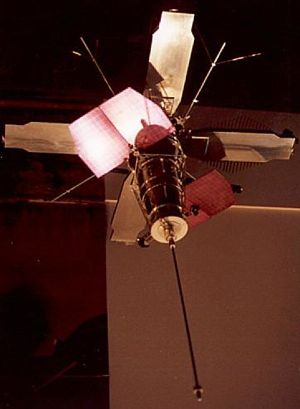
 Okean-O1 Okean-O1 model exhibited at Ukraine Pavilion, Hannover Expo 2000. The Tselina-D SIGINT satellite used the same satellite bus and was believed to be similar in experience. Credit: © Mark Wade |
AKA: Sich-1. Status: Operational 1986. First Launch: 1986-07-28. Last Launch: 2004-12-24. Number: 9 . Gross mass: 1,950 kg (4,290 lb).
Oceanographic research satellite, developed by KB-3 at NPO Yuzhnoye in the Ukraine, Vladimir Iosifovich Dranvoskiy, Chief Designer. The Okean oceanographic research satellite, later called Sich-1 by the Ukrainians, weighed 1950 kg, of which 505 kg was scientific instruments. Development was authorized on 5 May 1977 as one of the third generation of Soviet space systems. It was equipped with:
- SUOS pointing, orientation, and stabilization system including:
- Korall-A6 radio-command command-programming-trajectory system
- BR-91Ts radiotelemetry system
- STR thermoregulation system
- SEP electrical feed system
- SM-5 magnetometer
- RFA radiophysical instrument with:
- RLSBO side-looking radar with a swath width of 450 km and a resolution of 1.3 x 2.6 km
- RM-0.8 scanning radiometer with a swath width of 550 km and a resolution of 25 km
- RTBK radio-television complex with:
- MSU-M 4-band multispectral scanner with a swath width of 1900 km and a resolution of 1.8 km
- MSU-S 2-band multispectral scanner with a swath width of 1100 km and a resolution of 410 m
- Kondor-2 system for interrogation, acquisition, storage, and dumping of data from Kondor-1 earth ground stations
More at: Okean-O1.
| Okean-OE Ukrainian earth resources radar satellite. Ocean Observation satellite built by KB Yuzhnoye, Russia. Launched 1983 - 1984. |
Family: Earth, Earth resources radarsat, Medium earth orbit. Country: Ukraine. Launch Vehicles: Tsiklon, Tsiklon-3. Projects: Okean. Launch Sites: Plesetsk, Plesetsk LC32/2, Plesetsk LC32/1. Agency: Yuzhnoye, RAKA, RKA. Bibliography: 2, 5, 6, 12910, 12911.
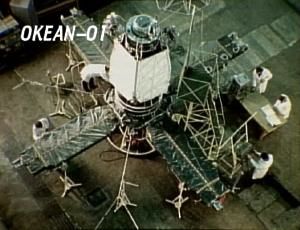
 | Okean-O1 Credit: Ukrainian Space Agency |
 | Cosmos 1766 Credit: Manufacturer Image |
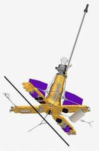
 | Sich-1M Credit: Manufacturer Image |
1983 September 28 - . 07:59 GMT - . Launch Site: Plesetsk. Launch Complex: Plesetsk LC32/1. LV Family: R-36. Launch Vehicle: Tsiklon-3.
- Cosmos 1500 - . Payload: Okean-OE no. 1. Mass: 1,950 kg (4,290 lb). Nation: Russia. Agency: MO. Program: Okean. Class: Earth. Type: Civilian Radarsat. Spacecraft Bus: Okean-O1. Spacecraft: Okean-OE. Completed Operations Date: 1986-07-16 . USAF Sat Cat: 14372 . COSPAR: 1983-099A. Apogee: 621 km (385 mi). Perigee: 596 km (370 mi). Inclination: 82.50 deg. Period: 96.90 min. Elaboration of new kinds of information-measuring apparatus and methods of remote investigation of the Pacific Ocean in the interests of science and of various branches of the national economy of the USSR. .
1984 September 28 - . 06:00 GMT - . Launch Site: Plesetsk. Launch Complex: Plesetsk LC32/2. LV Family: R-36. Launch Vehicle: Tsiklon-3.
- Cosmos 1602 - .
Payload: Okean-OE no. 2. Mass: 1,950 kg (4,290 lb). Nation: Russia.
Agency: MO.
Program: Okean.
Class: Earth.
Type: Civilian Radarsat. Spacecraft Bus: Okean-O1.
Spacecraft: Okean-OE.
Completed Operations Date: 1986-12-05 . USAF Sat Cat: 15331 . COSPAR: 1984-105A. Apogee: 628 km (390 mi). Perigee: 597 km (370 mi). Inclination: 82.50 deg. Period: 97.00 min.
Gathering of operational information and continued trials of new kinds of information and measurement apparatus and methods of remote investigation of the seas and oceans and the earth's surface in the interests of science and of various branches of the n ational economy of the USSR.
1986 July 28 - . 21:08 GMT - . Launch Site: Plesetsk. Launch Complex: Plesetsk LC32/2. LV Family: R-36. Launch Vehicle: Tsiklon-3.
- Cosmos 1766 - .
Payload: Okean-O1 no. 1. Mass: 1,950 kg (4,290 lb). Nation: Russia.
Agency: MO.
Program: Okean.
Class: Earth.
Type: Civilian Radarsat. Spacecraft: Okean-O1.
Completed Operations Date: 1988-10-24 . USAF Sat Cat: 16881 . COSPAR: 1986-055A. Apogee: 631 km (392 mi). Perigee: 601 km (373 mi). Inclination: 82.50 deg. Period: 97.00 min.
Oceanographic. Acquisition of operational oceanographic information in the interests of various branches of the national economy of the USSR and international cooperation; continued trials of new types of informational and measurement apparatus and methods of remote sen sing of the earth's surface and atmosphere.
1987 July 16 - . 04:25 GMT - . Launch Site: Plesetsk. Launch Complex: Plesetsk LC32/2. LV Family: R-36. Launch Vehicle: Tsiklon-3.
- Cosmos 1869 - . Payload: Okean-O1 no. 2. Mass: 1,950 kg (4,290 lb). Nation: Russia. Agency: MO. Program: Okean. Class: Earth. Type: Civilian Radarsat. Spacecraft: Okean-O1. Completed Operations Date: 1989-05-30 . USAF Sat Cat: 18214 . COSPAR: 1987-062A. Apogee: 632 km (392 mi). Perigee: 602 km (374 mi). Inclination: 82.50 deg. Period: 97.10 min. Oceanographic. Acquisition of operational oceanographic information in the interests of various branches of the national economy of the USSR and international cooperation. .
1988 July 5 - . 09:45 GMT - . Launch Site: Plesetsk. Launch Complex: Plesetsk LC32/1. LV Family: R-36. Launch Vehicle: Tsiklon-3.
- Okean 1 - . Payload: Okean-O1 no. 3. Mass: 1,950 kg (4,290 lb). Nation: Russia. Agency: MO. Program: Okean. Class: Earth. Type: Civilian Radarsat. Spacecraft: Okean-O1. Completed Operations Date: 1990-06-14 . USAF Sat Cat: 19274 . COSPAR: 1988-056A. Apogee: 633 km (393 mi). Perigee: 606 km (376 mi). Inclination: 82.50 deg. Period: 97.10 min. Oceanographic. Gathering of up-to-date oceanographic information and data on ice conditions in the interests of the Soviet economy and international cooperation. .
1989 June 9 - . 10:10 GMT - . Launch Site: Plesetsk. Launch Complex: Plesetsk LC32/2. LV Family: R-36. Launch Vehicle: Tsiklon-3. FAILURE: Stage 3 failure - third stage engine did not ignite for second burn.. Failed Stage: 3.
- Okean - . Payload: Okean-O1 no. 4. Mass: 1,950 kg (4,290 lb). Nation: Russia. Agency: UNKS. Program: Okean. Class: Earth. Type: Civilian Radarsat. Spacecraft: Okean-O1.
1990 February 28 - . 00:55 GMT - . Launch Site: Plesetsk. Launch Complex: Plesetsk LC32/2. LV Family: R-36. Launch Vehicle: Tsiklon-3.
- Okean 2 - . Payload: Okean-O1 no. 5. Mass: 1,950 kg (4,290 lb). Nation: Russia. Agency: MO. Program: Okean. Class: Earth. Type: Civilian Radarsat. Spacecraft: Okean-O1. Completed Operations Date: 1991-07-18 . USAF Sat Cat: 20510 . COSPAR: 1990-018A. Apogee: 646 km (401 mi). Perigee: 617 km (383 mi). Inclination: 82.50 deg. Period: 97.40 min. Oceanographic remote sensing. Gathering of up-to-date oceanographic information and data on ice conditions in the interests of the Soviet economy and international cooperation. .
1991 June 4 - . 08:10 GMT - . Launch Site: Plesetsk. Launch Complex: Plesetsk LC32/2. LV Family: R-36. Launch Vehicle: Tsiklon-3.
- Okean 3 - . Payload: Okean-O1 no. 6. Mass: 1,950 kg (4,290 lb). Nation: Russia. Agency: MOM. Program: Okean. Class: Earth. Type: Civilian Radarsat. Spacecraft: Okean-O1. Completed Operations Date: 1994-01-04 . USAF Sat Cat: 21397 . COSPAR: 1991-039A. Apogee: 656 km (407 mi). Perigee: 621 km (385 mi). Inclination: 82.50 deg. Period: 97.50 min. Oceanography. Gathering of up-to-date oceanographic information and data on ice conditions in the interests of the Soviet economy and international cooperation. Okean 3 ceased working in January of 1994..
1994 October 11 - . 14:30 GMT - . Launch Site: Plesetsk. Launch Complex: Plesetsk LC32/2. LV Family: R-36. Launch Vehicle: Tsiklon-3.
- Okean-O1 no. 7 - . Payload: Okean-O1 no. 7. Mass: 1,950 kg (4,290 lb). Nation: Russia. Agency: RAKA. Program: Okean. Class: Earth. Type: Civilian Radarsat. Spacecraft: Okean-O1. USAF Sat Cat: 23317 . COSPAR: 1994-066A. Apogee: 665 km (413 mi). Perigee: 631 km (392 mi). Inclination: 82.54 deg. Period: 97.70 min. Oceanography..
1995 August 31 - . 06:49 GMT - . Launch Site: Plesetsk. LV Family: R-36. Launch Vehicle: Tsiklon-3.
- Sich 1 - . Payload: Okean-O1 no. 8. Mass: 1,950 kg (4,290 lb). Nation: Russia. Agency: NKAU. Program: Okean. Class: Earth. Type: Civilian Radarsat. Spacecraft: Okean-O1. USAF Sat Cat: 23657 . COSPAR: 1995-046A. Apogee: 668 km (415 mi). Perigee: 631 km (392 mi). Inclination: 82.50 deg. Period: 97.70 min. Oceanographic remote sensing; carried FASat-Alfa microsat for Chile that failed to deploy..
2004 December 24 - . 11:20 GMT - . Launch Site: Plesetsk. Launch Complex: Plesetsk LC32/2. LV Family: R-36. Launch Vehicle: Tsiklon-3. FAILURE: Launch vehicle control system failure during third stage apogee kick burn..
- Sich-1M - . Payload: Okean O1-N9. Mass: 2,263 kg (4,989 lb). Nation: Ukraine. Agency: NKAU. Manufacturer: Yuzhnoye. Program: Okean. Class: Earth. Type: Civilian Radarsat. Spacecraft: Okean-O1. Decay Date: 2006-04-15 . USAF Sat Cat: 28505 . COSPAR: 2004-052A. Apogee: 650 km (400 mi). Perigee: 280 km (170 mi). Inclination: 82.56 deg. Ukranian-built remote sensing satellite. Originally tagged by USAF SpaceCom as Cosmos 2412. Third stage apogee kick burn was too short, raising the perigee of the orbit from 78 km to 280 km, rather than the 650 km planned..
Back to top of page
Home - Search - Browse - Alphabetic Index: 0- 1- 2- 3- 4- 5- 6- 7- 8- 9
A- B- C- D- E- F- G- H- I- J- K- L- M- N- O- P- Q- R- S- T- U- V- W- X- Y- Z
© 1997-2019 Mark Wade - Contact
© / Conditions for Use