Home - Search - Browse - Alphabetic Index: 0- 1- 2- 3- 4- 5- 6- 7- 8- 9
A- B- C- D- E- F- G- H- I- J- K- L- M- N- O- P- Q- R- S- T- U- V- W- X- Y- Z
KOMPSAT
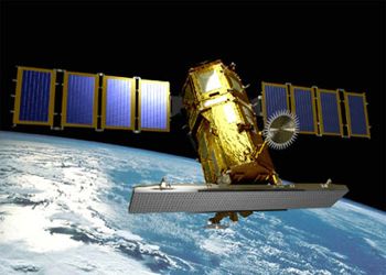
 Arirang-5 Credit: Manufacturer Image |
AKA: Arirang;Korea Multi-Purpose Satellite. Status: Operational 1999. First Launch: 1999-12-21. Last Launch: 2015-03-25. Number: 4 . Gross mass: 470 kg (1,030 lb).
TRW and Korean engineers worked together to develop the spacecraft.
The payload consisted of several scientific instruments as well as a Ka-band communications device. KOMPSAT was based on TRW's Eagle class of light weight, modular spacecraft. It had 3-axis stabilization with dual solar arrays. The payload included a 10 m resolution CCD imaging system supplied by Litton Itek Optical Systems. TRW supplied a low resolution camera for ocean and Earth resources monitoring. Other scientific instruments included a device to measure Earth's ionospheric and magnetic fields and a high-energy particle detector.
TRW signed the $ 32 million contract to develop the satellite on 19 September 1994.
More at: KOMPSAT.
Family: Communications technology sat, Earth, Sun synchronous orbit, Surveillance, Technology. Country: Korea South. Launch Vehicles: Taurus, Dnepr, Taurus 2110, H-IIA 202. Launch Sites: Vandenberg, Vandenberg 576E, Tanegashima Y. Agency: KARI, TRW. Bibliography: 2, 552, 554, 6, 6633, 12737, 12738, 12739.
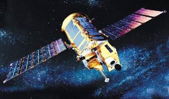
 | KOMPSAT Credit: Manufacturer Image |
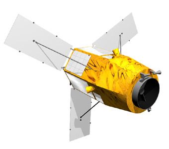
 | Arirang-3A Credit: Manufacturer Image |
1994 September 19 - .
- Kompsat contract - . Nation: Korea South. Spacecraft Bus: T200. Spacecraft: KOMPSAT. TRW and Korean engineers would work together to develop the spacecraft. KOMPSAT was based on TRW's Eagle class of light weight, modular spacecraft..
1999 December 21 - . 07:13 GMT - . Launch Site: Vandenberg. Launch Complex: Vandenberg 576E. LV Family: Taurus. Launch Vehicle: Taurus 2110.
- Kompsat - .
Payload: Arirang. Mass: 470 kg (1,030 lb). Nation: Korea South.
Agency: KARI.
Manufacturer: KAIST.
Class: Earth.
Type: Sea satellite. Spacecraft Bus: T200.
Spacecraft: KOMPSAT.
USAF Sat Cat: 26032 . COSPAR: 1999-070A. Apogee: 677 km (420 mi). Perigee: 670 km (410 mi). Inclination: 97.80 deg. Period: 98.20 min.
Korean Multipurpose Satellite; carried an ocean color sensor developed by TRW and particle detectors. KOMPSAT was built by the Korean Aerospace Research Institute (KARI) based on a test model built by TRW; it used the TRW STEP Lightsat bus and had a mass of around 500 kg, with 73 kg of hydrazine fuel.
2012 May 17 - . 16:39 GMT - . Launch Site: Tanegashima. Launch Complex: Tanegashima Y. LV Family: H-2. Launch Vehicle: H-IIA 202.
- Arirang-3 - . Payload: Kompsat-3. Mass: 800 kg (1,760 lb). Nation: Korea South. Class: Surveillance. Type: Military surveillance satellite. Spacecraft Bus: T200. Spacecraft: Kompsat. USAF Sat Cat: 38338 . COSPAR: 2012-025B. Apogee: 677 km (420 mi). Perigee: 665 km (413 mi). Inclination: 98.10 deg. Period: 98.20 min. South Korean imaging satellite..
2013 August 22 - . 14:39 GMT - . Launch Site: Dombarovskiy. Launch Pad: Yasniy Sh370/13. LV Family: R-36M. Launch Vehicle: Dnepr.
- Arirang-5 - . Payload: Kompsat-5. Mass: 1,400 kg (3,000 lb). Nation: Korea South. Class: Surveillance. Type: Surveillance satellite. Spacecraft Bus: T200. Spacecraft: Kompsat. USAF Sat Cat: 39227 . COSPAR: 2013-042A. Apogee: 560 km (340 mi). Perigee: 545 km (338 mi). Inclination: 97.60 deg. Period: 95.70 min. South Korea's first X-band SAR satellite..
2015 March 25 - . 22:08 GMT - . Launch Site: Dombarovskiy. Launch Complex: Yasniy Sh370/13. LV Family: R-36M. Launch Vehicle: Dnepr.
- Arirang-3A - . Payload: KOMPSAT 3A. Mass: 800 kg (1,760 lb). Nation: Korea South. Class: Surveillance. Type: Surveillance satellite. Spacecraft Bus: T200. Spacecraft: Kompsat. USAF Sat Cat: 40536 . COSPAR: 2015-014A. Apogee: 538 km (334 mi). Perigee: 522 km (324 mi). Inclination: 97.53 deg. Period: 95.23 min. South Korean imaging satellite with submeter resolution. Sun synchronous orbit; 0130 GMT local time of the descending node..
Back to top of page
Home - Search - Browse - Alphabetic Index: 0- 1- 2- 3- 4- 5- 6- 7- 8- 9
A- B- C- D- E- F- G- H- I- J- K- L- M- N- O- P- Q- R- S- T- U- V- W- X- Y- Z
© 1997-2019 Mark Wade - Contact
© / Conditions for Use