Home - Search - Browse - Alphabetic Index: 0- 1- 2- 3- 4- 5- 6- 7- 8- 9
A- B- C- D- E- F- G- H- I- J- K- L- M- N- O- P- Q- R- S- T- U- V- W- X- Y- Z
GEOS
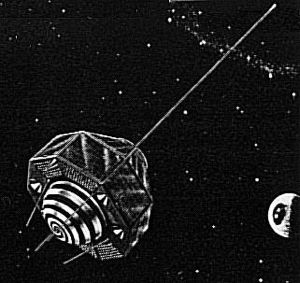
 GEOS-A Credit: NASA |
Status: Operational 1965. First Launch: 1965-11-06. Last Launch: 1975-04-09. Number: 3 . Gross mass: 341 kg (751 lb).
They were flown as part of the National Geodetic Satellite Program.
Instrumentation varied by mission, with the objectives of locating observation points (geodetic control stations) in a three dimensional earth center-of-mass coordinate system within 10 m of accuracy, to determine the structure of the Earth's gravity field to 5 parts in 10 million, of defining the structure of the earth's irregular gravitational field and refining the locations and magnitudes of the large gravity anomalies, and of comparing results of the various systems onboard the spacecraft to determine the most accurate and reliable system. Acquisition and recording of data were the responsibility of the GSFC Space Tracking and Data Acquisitions Network (STADAN). Ten major observing networks were used.
GEOS-A was a 175 kg, 1.32 m diameter, top-shaped satellite. It had an array of 5 geodetic systems: flashing light beacons, radio Doppler transmitters, a radio range system, a combined range and range rate system, and a laser reflector. Primary power for the instrumentation was obtained from solar cells that covered most of the exterior of the satellite.
The program was directed by NASA's Goddard Space Flight Center. Prime Contractor was The Johns Hopkins University Applied Physics Laboratory.
More at: GEOS.
| GEOS 3 Altimetry satellite built by Johns Hopkins Applied Physics Laboratory for NASA, USA. Launched 1975. |
Family: Astronomy, Medium earth orbit, Solar. Country: USA. Launch Vehicles: Thor, Delta, Thor Delta E, Thor Delta E1, Delta 1410, Delta 1000. Projects: Explorer. Launch Sites: Cape Canaveral, Vandenberg, Cape Canaveral LC17A, Vandenberg SLC2E, Vandenberg SLC2W. Agency: NASA, APL. Bibliography: 2, 3750, 3751, 3752, 405, 6, 6521, 12489, 12490.
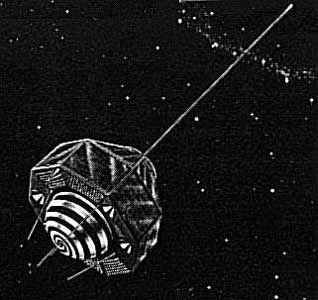
 | Explorer 29 Credit: Manufacturer Image |
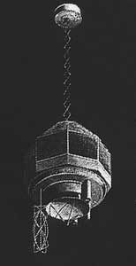
 | Geos 3 Credit: Manufacturer Image |
1965 November 6 - . 18:38 GMT - . Launch Site: Cape Canaveral. Launch Complex: Cape Canaveral LC17A. LV Family: Thor. Launch Vehicle: Thor Delta E.
- Explorer 29 - .
Payload: GEOS A. Mass: 175 kg (385 lb). Nation: USA.
Agency: NASA Greenbelt.
Program: Explorer.
Class: Astronomy.
Type: Solar satellite. Spacecraft: GEOS.
USAF Sat Cat: 1726 . COSPAR: 1965-089A. Apogee: 2,269 km (1,409 mi). Perigee: 1,120 km (690 mi). Inclination: 59.40 deg. Period: 120.30 min.
The primary objective of GEOS-A was to provide global geodetic measurements for determining the positions of fiducial control points on the Earth to an accuracy of 10 meters in an Earth centre of mass co-ordinate system, and to determine the structure of the Earth's gravity field to 5 parts in 10 million. Instrumentation included (1) four optical beacons, (2) laser reflectors, (3) a radio range transponder, (4) Doppler beacons, and (5) a range and range rate transponder. These were designed to operate simultaneously to fulfil the objectives of locating observation points (geodetic control stations) in a three dimensional earth centre-of-mass co-ordinate system within 10 m of accuracy, of defining the structure of the earth's irregular gravitational field and refining the locations and magnitudes of the large gravity anomalies, and of comparing results of the various systems onboard the spacecraft to determine the most accurate and reliable system. In January 1967, a failure in the satellite's command system rendered several geodetic systems inoperable. Radio doppler measurements and the passive laser reflector experiment could continue indefinitely, however. Additional Details: here....
1968 January 11 - . 16:16 GMT - . Launch Site: Vandenberg. Launch Complex: Vandenberg SLC2E. LV Family: Thor. Launch Vehicle: Thor Delta E1.
- Explorer 36 - .
Payload: GEOS B. Mass: 209 kg (460 lb). Nation: USA.
Agency: NASA Greenbelt.
Program: Explorer.
Class: Astronomy.
Type: Solar satellite. Spacecraft: GEOS.
USAF Sat Cat: 3093 . COSPAR: 1968-002A. Apogee: 1,574 km (978 mi). Perigee: 1,081 km (671 mi). Inclination: 105.80 deg. Period: 112.20 min.
The geodetic instrumentation systems included (1) four optical beacons, (2) two C-band radar transponders, (3) a passive radar reflector, (4) a sequential collation of range radio range transponder, (5) a Goddard range and range rate transponder, (6) laser reflectors, and (7) Doppler beacons. Non-geodetic systems included a laser detector and a Minitrack interferometer beacon. The objectives of the spacecraft were to optimise optical station visibility periods and to provide complementary data for inclination-dependent terms established by the Explorer 29 (GEOS 1) gravimetric studies. The spacecraft was placed into a retrograde orbit to accomplish these objectives. Operational problems occurred in the main power system, optical beacon flash system, and the spacecraft clock, and adjustments in scheduling resulted in nominal operations.
1975 April 9 - . 23:58 GMT - . Launch Site: Vandenberg. Launch Complex: Vandenberg SLC2W. LV Family: Thor. Launch Vehicle: Delta 1410.
- Geos 3 - .
Payload: GEOS C. Mass: 341 kg (751 lb). Nation: USA.
Agency: NASA Wallops.
Class: Astronomy.
Type: Solar satellite. Spacecraft: Geos.
USAF Sat Cat: 7734 . COSPAR: 1975-027A. Apogee: 848 km (526 mi). Perigee: 817 km (507 mi). Inclination: 115.00 deg. Period: 101.60 min.
Geodynamics Experimental Ocean Satellite. The mission of GEOS 3 (Geodynamics Experimental Ocean Satellite) was to provide the stepping stone between the National Geodetic Satellite Program (NGSP) and the Earth and Ocean Physics Application Program. It provided data to refine the geodetic and geophysical results of the NGSP and served as a test for new systems. A major achievment was the flight of a radar altimeter. Further mission objectives: intercomparison of tracking systems, investigation of solid-earth dynamic phenomena through precision laser tracking, refinement of orbit determination techniques, determination of interdatum ties and gravity models, and support of the calibration and position determination of NASA Spaceflight Tracking and Data Network (STDN) S-band tracking stations.
Back to top of page
Home - Search - Browse - Alphabetic Index: 0- 1- 2- 3- 4- 5- 6- 7- 8- 9
A- B- C- D- E- F- G- H- I- J- K- L- M- N- O- P- Q- R- S- T- U- V- W- X- Y- Z
© 1997-2019 Mark Wade - Contact
© / Conditions for Use