Home - Search - Browse - Alphabetic Index: 0- 1- 2- 3- 4- 5- 6- 7- 8- 9
A- B- C- D- E- F- G- H- I- J- K- L- M- N- O- P- Q- R- S- T- U- V- W- X- Y- Z
SkySat
FURTHER INFORMATION ON THIS TOPIC AT OUR PARTNER SITE
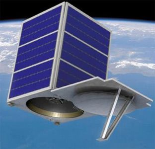
 SkySat 1 Credit: Manufacturer Image |
Status: Operational 2013. First Launch: 2013-11-21. Last Launch: 2014-07-08. Number: 2 . Gross mass: 90 kg (198 lb). Apogee: 595 km (369 mi).
More at: SkySat.
| SkySat 3, ..., 21 (SkySat-2 1, ..., 19) Null |
Family: Surveillance. Country: USA. Launch Vehicles: R-7, Dnepr, Soyuz-2-1B. Launch Sites: Baikonur LC31.
2013 November 21 - . 07:10 GMT - . Launch Site: Dombarovskiy. Launch Pad: xxx. LV Family: R-36M. Launch Vehicle: Dnepr.
- SkySat-1 - . Mass: 90 kg (198 lb). Nation: USA. Class: Surveillance. Type: Surveillance satellite. Spacecraft: Skysat. USAF Sat Cat: 39418 . COSPAR: 2013-066C. Apogee: 595 km (369 mi). Perigee: 564 km (350 mi). Inclination: 97.79 deg. Period: 96.26 min. Imaging satellite, the first for the US company Skybox..
2014 July 8 - . 15:58 GMT - . Launch Site: Baikonur. Launch Complex: Baikonur LC31. LV Family: R-7. Launch Vehicle: Soyuz-2-1B.
- Skysat 2 - . Mass: 100 kg (220 lb). Nation: USA. Spacecraft: Skysat. USAF Sat Cat: 40072 . COSPAR: 2014-037D. Apogee: 635 km (394 mi). Perigee: 624 km (387 mi). Inclination: 98.40 deg. Period: 97.31 min. Commercial earth optical surveillance satellite by Skybox..
2016 June 22 - . 03:55 GMT - . Launch Site: Sriharikota. Launch Complex: Sriharikota SLP. Launch Vehicle: PSLV.
- SkySat 2G-1 - . Payload: SkySat C1. Nation: USA. Class: Surveillance. Type: Surveillance satellite. Spacecraft: Skysat. USAF Sat Cat: 41601 . COSPAR: 2016-040C. Apogee: 515 km (320 mi). Perigee: 501 km (311 mi). Inclination: 97.50 deg. A 110 kg imaging satellite for TerraBella's constellation.
2016 September 16 - . 01:43 GMT - . Launch Site: Kourou. Launch Complex: Kourou ELV. Launch Vehicle: Vega.
- SkySat-4 - .
Nation: Europe.
Class: Surveillance.
Type: Surveillance satellite. Spacecraft: Skysat.
USAF Sat Cat: 41773 . COSPAR: 2016-058D. Apogee: 502 km (311 mi). Perigee: 501 km (311 mi). Inclination: 97.40 deg.
Arianespace's Vega rocket made its 7th flight from Kourou. The AVUM upper stage made two burns to deploy TerraBella's SkySat 4 to 7 in a 500 km orbit at 0224 UTC, and then two further burns to put PeruSAT-1 in a 677 km orbit at 0326 UTC. The AVUM made a final burn to deorbit itself in the Indian Ocean west of Sumatra.
- SkySat-5 - . Nation: Europe. Class: Surveillance. Type: Surveillance satellite. Spacecraft: Skysat. USAF Sat Cat: 41774 . COSPAR: 2016-058E. Apogee: 502 km (311 mi). Perigee: 501 km (311 mi). Inclination: 97.40 deg.
- SkySat-6 - . Nation: Europe. Class: Surveillance. Type: Surveillance satellite. Spacecraft: Skysat. USAF Sat Cat: 41771 . COSPAR: 2016-058B. Apogee: 506 km (314 mi). Perigee: 497 km (308 mi). Inclination: 97.40 deg.
- SkySat-7 - . Nation: Europe. Class: Surveillance. Type: Surveillance satellite. Spacecraft: Skysat. USAF Sat Cat: 41772 . COSPAR: 2016-058C. Apogee: 503 km (312 mi). Perigee: 501 km (311 mi). Inclination: 97.40 deg.
Back to top of page
Home - Search - Browse - Alphabetic Index: 0- 1- 2- 3- 4- 5- 6- 7- 8- 9
A- B- C- D- E- F- G- H- I- J- K- L- M- N- O- P- Q- R- S- T- U- V- W- X- Y- Z
© 1997-2019 Mark Wade - Contact
© / Conditions for Use