
Home - Search - Browse - Alphabetic Index: 0- 1- 2- 3- 4- 5- 6- 7- 8- 9
A- B- C- D- E- F- G- H- I- J- K- L- M- N- O- P- Q- R- S- T- U- V- W- X- Y- Z
Ofeq 3
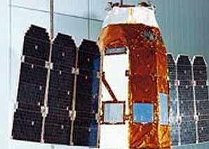 Ofeq-3 |
AKA: EROS. Status: Operational 1995. First Launch: 1995-04-05. Last Launch: 2006-04-25. Number: 4 . Gross mass: 189 kg (416 lb). Height: 2.40 m (7.80 ft).
The spacecraft was an advance over the previous Ofeq designs, but was not capable of offering significant military-grade imagery. The satellite was believed to deliver imagery in the visible and ultraviolet bands with resolutions of approximately 1 meter.
The spacecraft's 3-axis control system provided 0.1 deg astronomical-class pointing accuracy. Data rate was 15 kbit/sec; command rate 5 kbit/sec. Payload mass was officially noted as 36 kg. Power was provided by twin 3-panel solar wings totaling 3.6 m. Rafael provided the blowdown Hydrazine Propulsion Module for despin from 65 rpm, final orbit positioning, stationkeeping and momentum wheel unloading. There were two branches of six 5 N and one 25 N thrusters. Very little information was available on the payloads carried. The follow-on Amos satellite costs were projected as 7 units at $ 60 million each.
More at: Ofeq 3.
| EROS C Earth Observing satellite built by IAI for ImageSat International. Used Ofeq-3 Bus. |
Family: Military surveillance sat, Surveillance, Surveillance orbit. Country: Israel. Launch Vehicles: Topol', Shaviyt, Start-1, Shaviyt 1. Projects: Ofeq. Launch Sites: Palmachim, Svobodniy, Svobodniy LC5. Agency: IAI. Bibliography: 2, 4, 552, 554, 6, 6746, 12900, 12901, 12902.
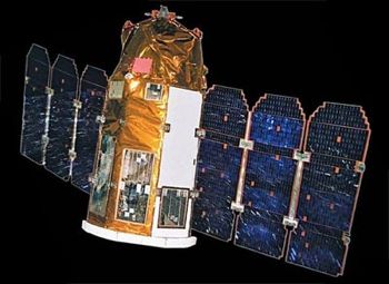 | EROS-B Credit: Manufacturer Image |
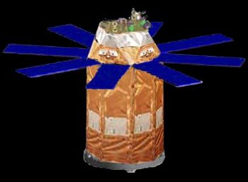 | EROS C Credit: Manufacturer Image |
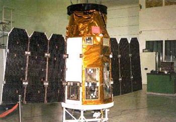 | Ofeq-3 Credit: Manufacturer Image |
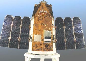 | EROS A1 Credit: Manufacturer Image |
1995 April 5 - . 11:16 GMT - . Launch Site: Palmachim. LV Family: Jericho. Launch Vehicle: Shaviyt 1.
- Ofeq-3 - . Mass: 189 kg (416 lb). Nation: Israel. Agency: ISA. Program: Ofeq. Class: Surveillance. Type: Military surveillance satellite. Spacecraft: Ofeq 3. Decay Date: 2000-10-24 . USAF Sat Cat: 23549 . COSPAR: 1995-018A. Apogee: 694 km (431 mi). Perigee: 366 km (227 mi). Inclination: 143.40 deg. Period: 94.50 min.
1998 January 22 - . 12:56 GMT - . Launch Site: Palmachim. LV Family: Jericho. Launch Vehicle: Shaviyt 1. FAILURE: Launch vehicle failed during second stage burn.. Failed Stage: 2.
- Ofeq-4 - . Mass: 189 kg (416 lb). Nation: Israel. Agency: ISA. Manufacturer: IAI. Program: Ofeq. Class: Surveillance. Type: Military surveillance satellite. Spacecraft: Ofeq 3. Fell in Mediterranean Sea..
2000 December 5 - . Launch Site: Svobodniy. Launch Complex: Svobodniy LC5. LV Family: Topol'. Launch Vehicle: Start-1.
- EROS A1 - .
Mass: 240 kg (520 lb). Nation: Israel.
Agency: ImageSat.
Manufacturer: IAI.
Class: Surveillance.
Type: Civilian surveillance satellite. Spacecraft: Ofeq 3.
Decay Date: 2016-07-07 . USAF Sat Cat: 26631 . COSPAR: 2000-079A. Apogee: 542 km (336 mi). Perigee: 533 km (331 mi). Inclination: 97.60 deg. Period: 95.40 min.
Launch delayed from November 28. The Israeli commercial imaging satellite EROS A1 was owned by ImageSat (an Israeli-led company registered in the Netherlands Antilles) and built by IAI using the Ofeq-3 design. EROS A1 was placed in a sun-synchronous orbit together with the DS 5th stage. The 250 kg (dry mass) triaxially stabilized spacecraft carried a black and white high resolution (1.8 m) CCD camera, to obtain images (with terrain width of 12.6 km) of locations chosen by Israeli military or world-wide commercial clients, and downlink them at one of the 14 ground stations.
2006 April 25 - . 16:47 GMT - . Launch Site: Svobodniy. Launch Complex: Svobodniy LC5. LV Family: Topol'. Launch Vehicle: Start-1.
- EROS-B - . Mass: 350 kg (770 lb). Nation: Israel. Agency: ImageSat. Manufacturer: IAI. Class: Surveillance. Type: Civilian surveillance satellite. Spacecraft: Ofeq 3. USAF Sat Cat: 29079 . COSPAR: 2006-014A. Apogee: 514 km (319 mi). Perigee: 505 km (313 mi). Inclination: 97.30 deg. Period: 94.80 min. Combined civilian/military imaging satellite operated by an Israeli company incorporated in the Cayman Islands. Its capability was demonstrated when, within days of launch, sharp photographs of people and motor vehicles on a Syrian dam were released..
Back to top of page
Home - Search - Browse - Alphabetic Index: 0- 1- 2- 3- 4- 5- 6- 7- 8- 9
A- B- C- D- E- F- G- H- I- J- K- L- M- N- O- P- Q- R- S- T- U- V- W- X- Y- Z
© 1997-2019 Mark Wade - Contact
© / Conditions for Use