
Home - Search - Browse - Alphabetic Index: 0- 1- 2- 3- 4- 5- 6- 7- 8- 9
A- B- C- D- E- F- G- H- I- J- K- L- M- N- O- P- Q- R- S- T- U- V- W- X- Y- Z
Galileo Navsat
 Galileo Navsat |
AKA: Adam;Alba;Anastasia;David;Doresa;GalileoSat;Milena;Natalia;Orlana;Sif;Thijs. Status: Operational 2011. First Launch: 2011-10-21. Last Launch: 2015-09-11. Number: 10 . Gross mass: 733 kg (1,615 lb).
Despite potential budget overruns and schedule delays, it was considered a strategic necessity, providing Europe with a navigation system for critical applications not subject to control by the Americans (GPS) or Russians (GLONASS). At the same time Galileo would be inter-operable with both GPS and GLONASS.
A user would be able to take a position with the same receiver from any of the satellites in any combination. By offering dual frequencies as standard, however, Galileo would deliver real-time positioning accuracy down to the meter range, which was unprecedented for a publicly available system.
It would guarantee availability of the service under all but the most extreme circumstances and would inform users within seconds of a failure of any satellite. This would make it suitable for applications where safety was crucial, such as running trains, guiding cars and landing aircraft.
The first experimental satellite, part of the so-called Galileo System Test Bed (GSTB) was to be launched in mid-2005. However the project reached almost immediate budget overruns. The objective of this experimental satellite was to characterize the critical technologies, which were already under development under ESA contracts. Thereafter up to four operational satellites would be launched in the timeframe 2005-2006 to validate the basic Galileo space and related ground segment. Once this In-Orbit Validation (IOV) phase had been completed, the remaining satellites would be installed to reach the Full Operational Capability (FOC) in 2008.
The fully deployed Galileo system was to consist of 30 satellites (27 operational + 3 active spares), positioned in three circular Medium Earth Orbit (MEO) planes in 23616 km altitude above the Earth, and at an inclination of the orbital planes of 56 degrees with reference to the equatorial plane. Once this was achieved, the Galileo navigation signals would provide a good coverage even at latitudes up to 75 degrees north, which corresponds to the North Cape, and beyond. The large number of satellites together with the optimization of the constellation, and the availability of the three active spare satellites, would ensure that the loss of one satellite had no discernible effect on the user.
Two Galileo Control Centers (GCC) would be implemented on European ground to provide for the control of the satellites and to perform the navigation mission management. The data provided by a global network of twenty Galileo Sensor Stations (GSS) would be sent to the Galileo Control Centers through a redundant communications network. The GCC's would use the data of the Sensor Stations to compute the integrity information and to synchronize the time signal of all satellites and of the ground station clocks. The exchange of the data between the Control Centers and the satellites would be performed through so-called up-link stations. Five S-band up-link stations and 10 C-band up-link stations would be installed around the globe for this purpose.
As a further feature, Galileo would provide a global Search and Rescue (SAR) function, based on the operational Cospas-Sarsat system. To do so, each satellite would be equipped with a transponder, which would be able to transfer the distress signals from the user transmitters to the Rescue Co-ordination Centre, which would then initiate the rescue operation. At the same time, the system would provide a signal to the user, informing him that his situation had been detected and that help was under way. This latter feature was new and was considered a major upgrade compared to the existing system, which did not provide a feedback to the user.
More at: Galileo Navsat.
Family: Navigation. Country: Europe. Launch Vehicles: R-7, Soyuz-FG, Soyuz-ST-B, Soyuz ST / Fregat ST. Launch Sites: Kourou ZLS, Baikonur, Kourou ELS. Agency: ESA. Bibliography: 728, 12469, 12470, 12471.
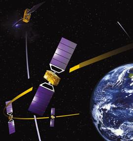
 | Galileo Navsat Credit: ESA |
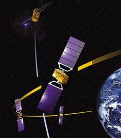
 | Galileo FOC FM01 Credit: Manufacturer Image |
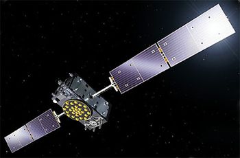
 | Galileo IOV-3 Credit: Manufacturer Image |
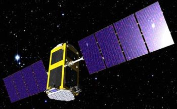 | GIOVE B Credit: Manufacturer Image |
2011 October 21 - . 10:30 GMT - . Launch Site: Kourou. Launch Complex: Kourou ELS. LV Family: R-7. Launch Vehicle: Soyuz-ST-B.
- GalileoSat-1 - . Payload: Galileo-PFM / Thijs. Mass: 640 kg (1,410 lb). Nation: Europe. Class: Navigation. Type: Navigation satellite. Spacecraft: Galileo Navsat. USAF Sat Cat: 37846 . COSPAR: 2011-060A. Apogee: 23,307 km (14,482 mi). Perigee: 23,234 km (14,436 mi). Inclination: 54.70 deg. Period: 846.80 min. First Galileo navigation satellites launched to establish an autonomous European navigation satellite constellation. First Soyuz booster launch from the new Ensemble de Lancement Soyuz pad in Kourou..
- GalileoSat-2 - . Payload: Galileo-FM2 / Natalia. Mass: 640 kg (1,410 lb). Nation: Europe. Class: Navigation. Type: Navigation satellite. Spacecraft: Galileo Navsat. USAF Sat Cat: 37847 . COSPAR: 2011-060B. Apogee: 23,274 km (14,461 mi). Perigee: 23,228 km (14,433 mi). Inclination: 54.70 deg. Period: 845.90 min.
2012 October 12 - . 18:15 GMT - . Launch Site: Kourou. Launch Complex: Kourou ELS. LV Family: R-7. Launch Vehicle: Soyuz-ST-B.
- GalileoSat-3 - . Payload: Galileo IOV-3 / David. Mass: 640 kg (1,410 lb). Nation: Europe. Class: Navigation. Type: Navigation satellite. Spacecraft: Galileo Navsat. USAF Sat Cat: 38857 . COSPAR: 2012-055A. Apogee: 23,228 km (14,433 mi). Perigee: 23,217 km (14,426 mi). Inclination: 55.30 deg. Period: 844.70 min. In-orbit validation satellite for the Galileo navigation system. Nicknamed David in honor a competition winner, Mr. David Markarjanc (b.2001) of the Czech Republic..
- GalileoSat-4 - . Payload: Galileo IOV-4 / Sif. Mass: 640 kg (1,410 lb). Nation: Europe. Class: Navigation. Type: Navigation satellite. Spacecraft: Galileo Navsat. USAF Sat Cat: 38858 . COSPAR: 2012-055B. Apogee: 23,227 km (14,432 mi). Perigee: 23,218 km (14,426 mi). Inclination: 55.30 deg. Period: 844.70 min. In-orbit validation satellite for the Galileo navigation system. Nicknamed Sif in honor a competition winner, Ms. Sif Skov Christensen (b.2002) of Denmark..
2014 August 22 - . 03:15 GMT - . Launch Site: Kourou. Launch Complex: Kourou ELS. LV Family: R-7. Launch Vehicle: Soyuz-ST-B.
- GalileoSat-5 - .
Payload: Galileo FOC FM01 / Doresa. Mass: 733 kg (1,615 lb). Nation: Europe.
Agency: AE.
Spacecraft: Galileo Navsat.
USAF Sat Cat: 40128 . COSPAR: 2014-050A. Apogee: 25,918 km (16,104 mi). Perigee: 13,721 km (8,525 mi). Inclination: 49.69 deg. Period: 703.33 min.
Europe's first two Galileo FOC (Full Operational Capability) navigation satellites were put on a suborbital trajectory by the booster. The Fregat-MT No. 1039 upper stage made a first burn to put the stack in elliptical transfer orbit, and then began the coast to apogee. At apogee at 16:05 GMT the Fregat made a second burn intended to circularize the orbit at 23500 km x and 55.0 deg inclination. The satellites separated from the Fregat at 16:15 GMT. Unfortunately the Fregat was wrongly oriented and the orbit actually reached was 13,700 x 25,900 km x 49.7 deg. An attitude control thrusters may have failed during the coast, leaving Fregat pointing the wrong way at second main engine ignition.
- GalileoSat-6 - . Payload: Galileo FOC FM02 / Milena. Mass: 733 kg (1,615 lb). Nation: Europe. Agency: AE. Spacecraft: Galileo Navsat. USAF Sat Cat: 40129 . COSPAR: 2014-050B. Apogee: 25,906 km (16,097 mi). Perigee: 13,702 km (8,514 mi). Inclination: 49.69 deg. Period: 702.69 min.
2015 March 27 - . 21:46 GMT - . Launch Site: Kourou. Launch Complex: Kourou ELS. LV Family: R-7. Launch Vehicle: Soyuz ST / Fregat ST.
- GalileoSat-7 - . Payload: Galileo FOC FM03 / Adam. Mass: 733 kg (1,615 lb). Nation: Europe. Class: Navigation. Type: Navigation satellite. Spacecraft: Galileo Navsat. USAF Sat Cat: 40544 . COSPAR: 2015-017A. Apogee: 23,234 km (14,436 mi). Perigee: 23,210 km (14,420 mi). Inclination: 55.19 deg. Period: 844.70 min. European navigation satellite..
- GalileoSat-8 - . Payload: Galileo FOC FM04 / Anastasia. Mass: 733 kg (1,615 lb). Nation: Europe. Class: Navigation. Type: Navigation satellite. Spacecraft: Galileo Navsat. USAF Sat Cat: 40545 . COSPAR: 2015-017B. Apogee: 23,234 km (14,436 mi). Perigee: 23,210 km (14,420 mi). Inclination: 55.20 deg. Period: 844.69 min. European navigation satellite..
2015 September 11 - . 02:08 GMT - . Launch Site: Kourou. Launch Complex: Kourou ZLS. LV Family: R-7. Launch Vehicle: Soyuz ST / Fregat ST.
- GalileoSat-9 - . Payload: Galileo FOC FM05 / Alba. Mass: 733 kg (1,615 lb). Nation: Europe. Class: Navigation. Type: Navigation satellite. Spacecraft: Galileo Navsat. USAF Sat Cat: 40889 . COSPAR: 2015-045A. Apogee: 23,233 km (14,436 mi). Perigee: 23,211 km (14,422 mi). Inclination: 57.38 deg. Period: 844.70 min. Two European navigation satellites in the Galileo system. The Fregat upper stage deployed them in plane A of the system, at an inclination of 57.4 degrees (satellites in the existing B and C planes are in 55.0 degree orbits)..
- GalileoSat-10 - . Payload: Galileo FOC FM06 / Orlana. Mass: 733 kg (1,615 lb). Nation: Europe. Class: Navigation. Type: Navigation satellite. Spacecraft: Galileo Navsat. USAF Sat Cat: 40890 . COSPAR: 2015-045B. Apogee: 23,231 km (14,435 mi). Perigee: 23,213 km (14,423 mi). Inclination: 57.38 deg. Period: 844.70 min.
2015 December 17 - . 11:51 GMT - . Launch Site: Kourou. Launch Complex: Kourou ELS. LV Family: R-7. Launch Vehicle: Soyuz-ST-B.
- GalileoSat-11 - . Nation: Europe. Class: Navigation. Type: Navigation satellite. Spacecraft: Galileo Navsat. USAF Sat Cat: 41174 . COSPAR: 2015-079A. Apogee: 23,568 km (14,644 mi). Perigee: 23,511 km (14,609 mi). Inclination: 55.00 deg. Adriana.
- GalileoSat-12 - . Nation: Europe. Class: Navigation. Type: Navigation satellite. Spacecraft: Galileo Navsat. USAF Sat Cat: 41175 . COSPAR: 2015-079B. Apogee: 23,617 km (14,674 mi). Perigee: 23,552 km (14,634 mi). Inclination: 55.00 deg. Liene.
2016 May 24 - . 08:48 GMT - . Launch Site: Kourou. Launch Complex: Kourou ELS. LV Family: R-7. Launch Vehicle: Soyuz-ST-B.
- GalileoSat-13 - . Nation: Europe. Class: Navigation. Type: Navigation satellite. Spacecraft: Galileo Navsat. USAF Sat Cat: 41550 . COSPAR: 2016-030B. Apogee: 23,566 km (14,643 mi). Perigee: 23,551 km (14,633 mi). Inclination: 57.40 deg. Daniele.
- GalileoSat-14 - . Nation: Europe. Class: Navigation. Type: Navigation satellite. Spacecraft: Galileo Navsat. USAF Sat Cat: 41549 . COSPAR: 2016-030A. Apogee: 23,616 km (14,674 mi). Perigee: 23,553 km (14,635 mi). Inclination: 57.40 deg. Alizee.
2016 November 17 - . 13:06 GMT - . Launch Site: Kourou. Launch Complex: Kourou ELA3. LV Family: Ariane 5. Launch Vehicle: Ariane 5ES.
- GalileoSat-15 - .
Payload: Galileo 15 (267). Nation: Europe.
Class: Navigation.
Type: Navigation satellite. Spacecraft: Galileo Navsat.
USAF Sat Cat: 41859 . COSPAR: 2016-069A. Apogee: 22,906 km (14,233 mi). Perigee: 22,879 km (14,216 mi). Inclination: 54.60 deg.
Four more European navigation satellites in the Galileo system were launched. An Ariane 5ES rocket was used; the restartable EPS upper stage placed the satellites (FM07, FM12, FM13 and FM14, redesignated GalileoSat 15 to 18 after launch) in orbit. The 5ES model was previously used for ATV cargo ship launches.
- GalileoSat-16 - . Payload: Galileo 16 (26C). Nation: Europe. Class: Navigation. Type: Navigation satellite. Spacecraft: Galileo Navsat. USAF Sat Cat: 41860 . COSPAR: 2016-069B. Apogee: 22,926 km (14,245 mi). Perigee: 22,890 km (14,220 mi). Inclination: 54.60 deg.
- GalileoSat-17 - . Payload: Galileo 17 (26D). Nation: Europe. Class: Navigation. Type: Navigation satellite. Spacecraft: Galileo Navsat. USAF Sat Cat: 41861 . COSPAR: 2016-069C. Apogee: 22,912 km (14,236 mi). Perigee: 22,901 km (14,229 mi). Inclination: 54.60 deg.
- GalileoSat-18 - . Payload: Galileo 18 (26E). Nation: Europe. Class: Navigation. Type: Navigation satellite. Spacecraft: Galileo Navsat. USAF Sat Cat: 41862 . COSPAR: 2016-069D. Apogee: 22,899 km (14,228 mi). Perigee: 22,898 km (14,228 mi). Inclination: 54.50 deg.
Back to top of page
Home - Search - Browse - Alphabetic Index: 0- 1- 2- 3- 4- 5- 6- 7- 8- 9
A- B- C- D- E- F- G- H- I- J- K- L- M- N- O- P- Q- R- S- T- U- V- W- X- Y- Z
© 1997-2019 Mark Wade - Contact
© / Conditions for Use