
Home - Search - Browse - Alphabetic Index: 0- 1- 2- 3- 4- 5- 6- 7- 8- 9
A- B- C- D- E- F- G- H- I- J- K- L- M- N- O- P- Q- R- S- T- U- V- W- X- Y- Z
ERS 1-2
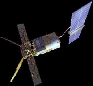 ERS 1 Credit: Manufacturer Image |
AKA: European Remote Sensing Satellite. Status: Operational 1991. First Launch: 1991-07-17. Last Launch: 1995-04-21. Number: 2 . Gross mass: 2,450 kg (5,400 lb). Height: 11.00 m (36.00 ft).
The satellites provided systematic, repetitive global measurements of wind speed and direction, wave height, surface temperatures, surface altitude, cloud cover, and atmospheric water vapor levels.
Data from ERS-1 was shared with NASA under a reciprocal agreement for Seasat and Nimbus 7 data. Some land imaging was performed with the satellites' SAR experiment. The satellites were controlled from ESA's Darmstadt control center, with a large number of other stations providing additional tracking coverage.
The spacecraft was 3-Axis stabilized, zero momentum bias with control to 0.11 deg (pitch/roll) and 0.21 deg (yaw). The single solar panel was 11.7 m x 2.4 m and supported peak payload power of 2600 W. Battery storage capacity was 2650 WHr. The SAR antenna was 10 m x 1 m. S-Band communications were via a 2 kbps uplink. The high-rate X-Band downlink provided 105 Mbps and 15 Mbps. On-board recorders stored 6.5 Gbits.
Payloads were:
- AMI (Active Microwave Instrument) - included a SAR (Synthetic Aperture Radar), Wave Scatterometer, and Wind Scatterometer
- Radar Altimeter (RA)
- Scanning Radiometer and Sounder (ASTR-M)
- Laser Reflector (LRR) - used for precise orbit determination and RA calibration
- Precision Ranging Equipment (PRARE) - used for orbit determination.
ERS-2 carried the same suite of instruments as ERS-1 with the addition of the Global Ozone Measuring Equipment (GOME) which measured ozone distribution in the outer atmosphere.
Having given excellent service for nine years, over three times its planned lifetime, the ERS-1 mission was ended on 10 March 2000 by a failure in the on-board attitude control system. Since its launch on 17 July 1991, ESA's first sun-synchronous polar-orbiting mission, made 45 000 orbits, acquiring more than 1.5 million individual Synthetic Aperture Radar (SAR) scenes. ERS-1 SAR images, together with the data from other instruments on board, were delivered to a worldwide community of some 4000 users in science and applications. Surface winds derived from the scatterometer and altimeter were supplied to meteorological services worldwide since 1991. The duration of the mission also meant that scientists had already observed several El Nino phenomena through combined observations of surface currents, topography, temperatures and winds. The measurements of sea surface temperatures, critical to the understanding of climate change, made by the ERS-1 Along-Track Scanning Radiometer were the most accurate ever from space. All these critical measurements were continued and enhanced by the follow-on ERS-2 mission.
More at: ERS-1.
Family: Earth, Civilian radarsat, Sun synchronous orbit. Country: Europe. Launch Vehicles: Ariane, Ariane 4, Ariane 40. Launch Sites: Kourou, Kourou ELA2. Agency: ESA, Dornier, Matra Marconi. Bibliography: 2, 6, 12321.
1991 July 17 - . 01:46 GMT - . Launch Site: Kourou. Launch Complex: Kourou ELA2. LV Family: Ariane. Launch Vehicle: Ariane 40.
- ERS 1 - .
Mass: 2,384 kg (5,255 lb). Nation: Europe.
Agency: ESA.
Class: Earth.
Type: Civilian Radarsat. Spacecraft: ERS 1-2.
USAF Sat Cat: 21574 . COSPAR: 1991-050A. Apogee: 775 km (481 mi). Perigee: 774 km (480 mi). Inclination: 98.50 deg. Period: 100.30 min.
Microwave, IR imaging of oceans, ice and land; SAR. ERS-1 was an Earth exploration satellite, using active and passive sensors for oceanography etc. Frequency plan: 2048.85/2225 MHz (TTC), 7225.2960/8489 MHz (PRARE), 8040, 8140 MHz (data transmission). Launch time 0146:31 UT. Designator ESA/91/02.
1995 April 21 - . 01:44 GMT - . Launch Site: Kourou. Launch Complex: Kourou ELA2. LV Family: Ariane. Launch Vehicle: Ariane 40.
- ERS 2 - . Mass: 2,516 kg (5,546 lb). Nation: Europe. Agency: ESA. Class: Earth. Type: Civilian Radarsat. Spacecraft: ERS 1-2. USAF Sat Cat: 23560 . COSPAR: 1995-021A. Apogee: 785 km (487 mi). Perigee: 784 km (487 mi). Inclination: 98.60 deg. Period: 100.50 min. European Remote Sensing; carried SAR; ocean, land, ice, and atmospheric observations..
Back to top of page
Home - Search - Browse - Alphabetic Index: 0- 1- 2- 3- 4- 5- 6- 7- 8- 9
A- B- C- D- E- F- G- H- I- J- K- L- M- N- O- P- Q- R- S- T- U- V- W- X- Y- Z
© 1997-2019 Mark Wade - Contact
© / Conditions for Use