Home - Search - Browse - Alphabetic Index: 0- 1- 2- 3- 4- 5- 6- 7- 8- 9
A- B- C- D- E- F- G- H- I- J- K- L- M- N- O- P- Q- R- S- T- U- V- W- X- Y- Z
WorldView
 WorldView |
AKA: BCP-5000. Status: Operational 2007. First Launch: 2007-09-18. Last Launch: 2009-10-08. Number: 2 . Gross mass: 2,500 kg (5,500 lb). Height: 2.50 m (8.20 ft). Diameter: 3.60 m (11.80 ft).
Best resolution available to commercial customers was 50 cm. However higher-resolution images were sold to DigitalGlobe's main customer, the US National Geospatial Intelligence Agency (NGA).
The satellite was an ultra-stable 3-axis stabilized platform, using high-precision attitude sensors and GPS. Control Moment Gyros (CMGs) provided orientation and Star trackers, a solid state IRU, and GPS provided positional and orientation data . Rapid retargeting was possible using the Control Moment Gyros (>2x faster than any competitor) . WorldView collected, stored and downlinked a greater supply of frequently updated global imagery products than competitive systems. It offered the broadest range of collection sizes, without sacrificing capacity from small points to long strips and large areas.
Stereoscopic areas could be imaged on a single pass, ensuring image continuity and consistency of quality. Direct downlink to customer sites was available using the same high-speed 800 Mbps X-band downlink. This expedited image processing and delivery to customers where speed was a driving factor. WorldView extended the range of suitable imaging collection targets and enhanced image interpretability, because images could be acquired at even the lowest light levels. Frequent revisits increased image collection opportunities, enhanced change detection applications and enabled accurate map updates
Specifications
- Highest resolution available commercially: 50 cm panchromatic at nadir / 55 cm out to 20 deg off-nadir
- Geolocation Accuracy predicted performance in the range of 3.0 to 7.6 meters CE90, excluding terrain and off-nadir effects. With registration to GCPs in image: 2.0 meters (6.6 feet) CE90
- 17.6 km width imaging swath (wider than any competitor)
- 2199 gigabits on-board storage
- 800 Mbps X-band data downlink
- World-class telescope with high contrast (MTF) and signal to noise ratio, selectable Time Delay Integration (TDI) levels, 11-bit dynamic range
- Revisits at high resolution: 1.7 days at 1 m GSD or less; 5.4 days at 20 deg off-nadir or less (51 cm GSD = Ground Sample Distance)
- Orbit: 496 kilometers Sun synchronous, 10:30 am descending node, 94.6 minute period
- Sensor Bands: Panchromatic
- Panchromatic: Sensor Resolution: 0.50 meters GSD at nadir / 0.55 meters GSD at 20 deg off-nadir (note that imagery must be re-sampled to 0.5 meters for non-US Government customers)
- Dynamic Range: 11-bits per pixel
- Time Delay Integration (TDI): 6 selectable levels from 8 to 64
- Swath Width: 17.6 kilometers at nadir
- Pointing Accuracy & Knowledge: Accuracy: <500 meters at image start and stop Knowledge: Supports geolocation accuracy below
- Retargeting Agility: Acceleration: 2.5 deg/s/s; Rate: 4.5 deg/s; Time to slew 300 kilometers: 9 seconds
- Onboard Storage: 2199 gigabits solid state with EDAC
- Communications: Image and Ancillary Data: 800 Mbps X-band; Housekeeping: 4, 16 or 32 kbps real-time, 524 kbps stored, X-band
- Command: 2 or 64 kbps S-band
- Max Viewing Angle / Accessible Ground Swath: Nominally +/-40 deg off-nadir = 858 km wide swath. Higher angles selectively available
- Per Orbit Collection: 331 gigabits
- Max Contiguous Area Collected in a Single Pass: 60 x 110 km mono; 30 x 110 km stereo
- Revisit Frequency: 1.7 days at 1 meter GSD or less; 5.9 days at 20 deg off-nadir or less (0.51 meter GSD)
- Geolocation Accuracy: Specification of 12.2m CE90, with predicted performance in the range of 3.0 to 7.6 meters (10 to 25 feet) CE90, excluding terrain and off-nadir effects; With registration to GCPs in image : 2.0 meters (6.6 feet)
Electric System: 3.20 kWh.
More at: WorldView.
Family: Civilian surveillance satellite, Sun synchronous orbit, Surveillance. Country: USA. Launch Vehicles: Thor, Delta, Delta 7920-10C. Launch Sites: Vandenberg, Vandenberg SLC2W. Agency: DigitalGlobe. Bibliography: 2, 7025, 13351, 13352.
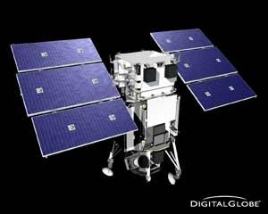
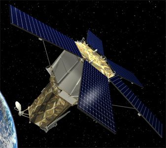
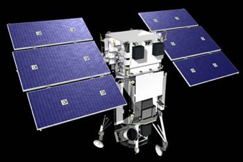
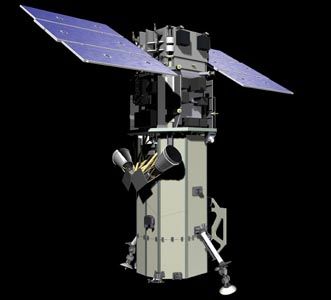
 | WorldView 4 Credit: Manufacturer Image |
 | WorldView 1 Credit: Manufacturer Image |
 | WorldView-2 Credit: Manufacturer Image |
2007 September 18 - . 18:35 GMT - . Launch Site: Vandenberg. Launch Complex: Vandenberg SLC2W. LV Family: Thor. Launch Vehicle: Delta 7920-10C.
- WorldView 1 - . Mass: 2,500 kg (5,500 lb). Nation: USA. Agency: Martin. Class: Surveillance. Type: Civilian surveillance satellite. Spacecraft Bus: BCP-5000. Spacecraft: WorldView. USAF Sat Cat: 32060 . COSPAR: 2007-041A. Apogee: 496 km (308 mi). Perigee: 492 km (305 mi). Inclination: 97.50 deg. Period: 94.50 min. Spacecraft was equipped with a 0.6-m aperture telescope for high resolution surveillance. Civilian, but primary customer was to be the US National Geospatial Intelligence Agency..
2009 October 8 - . 18:51 GMT - . Launch Site: Vandenberg. Launch Complex: Vandenberg SLC2W. LV Family: Thor. Launch Vehicle: Delta 7920-10C.
- WorldView-2 - . Mass: 2,615 kg (5,765 lb). Nation: USA. Agency: Martin. Class: Surveillance. Type: Surveillance satellite. Spacecraft Bus: BCP-5000. Spacecraft: WorldView. USAF Sat Cat: 35946 . COSPAR: 2009-055A. Apogee: 769 km (477 mi). Perigee: 766 km (475 mi). Inclination: 98.50 deg. Period: 100.20 min. Commercial 0.5-meter-resolution, 8-band imaging satellite..
Back to top of page
Home - Search - Browse - Alphabetic Index: 0- 1- 2- 3- 4- 5- 6- 7- 8- 9
A- B- C- D- E- F- G- H- I- J- K- L- M- N- O- P- Q- R- S- T- U- V- W- X- Y- Z
© 1997-2019 Mark Wade - Contact
© / Conditions for Use