
Home - Search - Browse - Alphabetic Index: 0- 1- 2- 3- 4- 5- 6- 7- 8- 9
A- B- C- D- E- F- G- H- I- J- K- L- M- N- O- P- Q- R- S- T- U- V- W- X- Y- Z
MTI
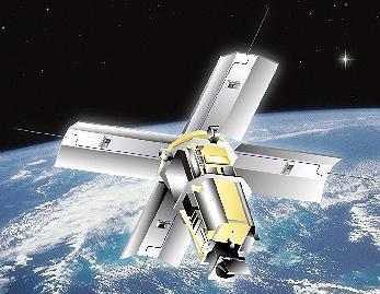 MTI Credit: NASA |
Status: Operational 2000. First Launch: 2000-03-12. Last Launch: 2000-03-12. Number: 1 . Gross mass: 587 kg (1,294 lb).
S. Department of Energy (DOE), Office of Nonproliferation and National Security. MTI's primary objective was to demonstrate advanced multispectral and thermal imaging, image processing, and associated technologies that could be used in future systems for detecting and characterizing facilities producing weapons of mass destruction using radiometrically accurate, high spatial resolution, multispectral imaging.
MTI technologies and experimental data also would be useful in developing future Department of Defense operations support and targeting systems.
The MTI satellite carried a sophisticated telescope that collected day and night images of the Earth in 15 spectral bands ranging from the visible to long-wave infrared. The unique imager, designed and built by a government and industry team led by Sandia National Laboratories and calibrated in a special facility at Los Alamos National Laboratory, gave the satellite performance previously achievable only in a laboratory setting. Hughes Research Laboratories in Santa Barbara, CA, built the focal plane array using three sensor chip assemblies with 12.5- and 50-µm pixels. The detectors were made of Si, InSb and HgCdTe. The instrument gathered light via a three-mirror anastigmatic optical assembly built by Hughes Danbury Optical Systems in Danbury, CT.
The satellite also carried a High-energy X-ray Spectrometer (HXRS) sponsored by the National Oceanic and Atmospheric Administration's Space Environment Center and the Czech Republic's Astronomical Institute of the Academy of Sciences, and developed by Space Devices, Ltd. of the Czech Republic. This instrument would collect data needed to better understand a rare species of solar flare associated with high-energy particle storms that could endanger astronauts and damage space equipment.
The Air Force Space and Missile Center's (SMC) Test and Evaluation Directorate launched the satellite into polar orbit on an Orbital Sciences Corporation Taurus rocket. The MTI satellite was launched into 555km circular orbit inclined at 97 degrees. The satellite's sun-synchronous orbit around the poles, put it at any given point at about the same local time every day. The spacecraft solar arrays were in normal operation Sun directed with ~1 degree pointing accuracy. Data downlinks would be made to the Sandria receiving station in central New Mexico on twice daily basis.
Project milestones included: 1993: Instrument requirements studies; 1993: Preliminary Design Review; 1994: Major contracts for satellite components let; 2000: Satellite launch (4 years late to original plan).
More at: MTI.
Family: Military surveillance sat, Sun synchronous orbit, Surveillance. Country: USA. Launch Vehicles: Taurus, Taurus 1110. Launch Sites: Vandenberg, Vandenberg 576E. Agency: Sandia. Bibliography: 2, 552, 554, 11484, 12863.
 | MTI Credit: Manufacturer Image |
2000 March 12 - . 09:29 GMT - . Launch Site: Vandenberg. Launch Complex: Vandenberg 576E. LV Family: Taurus. Launch Vehicle: Taurus 1110.
- MTI - . Mass: 587 kg (1,294 lb). Nation: USA. Agency: Los Alamos. Manufacturer: Sandia. Class: Surveillance. Type: Military surveillance satellite. Spacecraft Bus: BCP-600. Spacecraft: MTI. USAF Sat Cat: 26102 . COSPAR: 2000-014A. Apogee: 609 km (378 mi). Perigee: 574 km (357 mi). Inclination: 97.40 deg. Period: 96.42 min. Military Technology. Sandia Multispectral Thermal Imager (MTI), aka USAF Space Test Program mission P97-3. The satellite was equipped with a hyperspectral imager for military target recognition / treaty monitoring applications..
Back to top of page
Home - Search - Browse - Alphabetic Index: 0- 1- 2- 3- 4- 5- 6- 7- 8- 9
A- B- C- D- E- F- G- H- I- J- K- L- M- N- O- P- Q- R- S- T- U- V- W- X- Y- Z
© 1997-2019 Mark Wade - Contact
© / Conditions for Use