
Home - Search - Browse - Alphabetic Index: 0- 1- 2- 3- 4- 5- 6- 7- 8- 9
A- B- C- D- E- F- G- H- I- J- K- L- M- N- O- P- Q- R- S- T- U- V- W- X- Y- Z
IRS
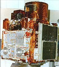 IRS-1C Credit: ISRC |
AKA: Cartosat;Megha;Resourcesat. Status: Operational 1988. First Launch: 1988-03-17. Last Launch: 2012-04-26. Number: 16 . Gross mass: 1,250 kg (2,750 lb).
Data from IRS satellites was received and processed by the National Remote Sensing Agency, Hyderabad. The US company SI also received and marketed IRS data worldwide under a commercial contract with the Antrix Corporation of the Indian Department of Space.
IRS-P6 was the tenth satellite of the IRS series, and carried three cameras similar to those of IRS-1C and IRS-1D but with improved spatial resolutions:
- A high resolution Linear Imaging Self Scanner (LISS-4) operating in three spectral bands in the Visible and Near Infrared Region (VNIR) with 5.8 meter spatial resolution and steerable up to plus/minus 26 deg across track to obtain stereoscopic imagery and achieve five day revisit capability
- A medium resolution LISS-3 operating in three spectral bands in VNIR and one in Short Wave Infrared (SWIR) band with 23.5 meter spatial resolution
- An Advanced Wide Field Sensor (AWiFS) operating in three spectral bands in VNIR and one band in SWIR with 56 meter spatial resolution.
Salient Features:
- Orbit: Circular Polar Sun Synchronous
- Orbit height: 817 km
- Orbit inclination: 98.7 deg
- Orbit period: 101.35 min
- Number of Orbits per day: 14
- Local Time of Equator crossing: 10.30 a.m.
- Repetitivity (LISS-3): 24 days
- Revisit (LISS-4): 5 days
- Lift-off Mass: 1360 kg
- Attitude and Orbit Control: 3-axis body stabilized using Reaction Wheels, Magnetic Torquers and Hydrazine Thrusters
- Power: Solar Array generating 1250 W, Two 24 Ah Ni-Cd batteries
- Mission Life: 5 years
More at: IRS.
| IRS 1E (IRS P1) Null |
| IRS P2 Earth Observing satellite for ISRO, India. Launched 1994. Used IRS-1 Bus. |
| IRS 1C, 1D Earth Observing satellite for ISRO, India. Launched 1995-1997. Used IRS-1 Bus. |
| IRS P3 Earth Observing satellite for ISRO, India. Launched 1996. Used IRS-1 Bus. |
| IRS P4 (Oceansat 1) Null |
| TES Indian military surveillance satellite. TES was an imaging satellite equipped with cameras and instruments to test military reconnaissance satellite technology. Earth Observing, Technology satellite for ISRO, India. Launched 2001. Used IRS-1 Bus. |
| IRS P6 (Resourcesat 1) Null |
| IRS P5 (Cartosat 1) Null |
| Cartosat 2, 2A, 2B, 2C, 2D, 2E Earth Observing satellite for ISRO, India. Launched 2007-2017. Used IRS-2 Bus. |
| Oceansat Remote sensing satellite with an 8-band ocean color monitor, a radar scatterometer and a radio occultation atmospheric sounder. Earth Observing satellite for ISRO, India. Launched 2009. Used IRS-1 Bus. |
| Resourcesat 2, 2A Earth Observing satellite for ISRO, India. Launched 2011-2016. Used IRS-1 Bus. |
| Megha-Tropiques Earth Science satellite built by Alcatel Space, ISRO for ISRO, CNES, India. Launched 2011. Used IRS Bus. |
| AstroSat Remote sensing satellite for the Vietnam Academy of Science and Technology. Used the [Myriade] bus. |
| Cartosat 3, 3A, 3B Earth Observing satellite for ISRO, India. Used IRS-2 Bus. |
| Oceansat 3, 3A Earth Observing satellite for ISRO, India. Used IRS-1 Bus. |
| Resourcesat 3, 3A, 3B Earth Observing satellite for ISRO, India. Used IRS-1 Bus. |
| Resourcesat 3S, 3SA Earth Observing satellite for ISRO, India. Used IRS-1 Bus. |
Family: Earth, Earth land resource sat, Sun synchronous orbit, Surveillance. Country: India. Launch Vehicles: R-7, Molniya 8K78M, Vostok 8A92M, PSLV, PSLV-XL. Launch Sites: Baikonur, Baikonur LC31, Sriharikota, Sriharikota PSLV, Sriharikota SLP. Agency: ISRO. Bibliography: 2, 279, 4, 6, 11237, 12675, 12676, 12677, 12678, 12679, 12680, 12681, 12682, 12683, 12684, 12685.
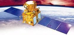 | IRS |
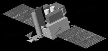 | Astrosat Credit: Manufacturer Image |
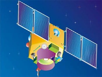 | Cartosat-2 Credit: Manufacturer Image |
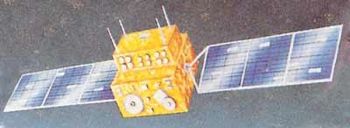 | IRS-1A Credit: Manufacturer Image |
 | IRS-1C Credit: Manufacturer Image |
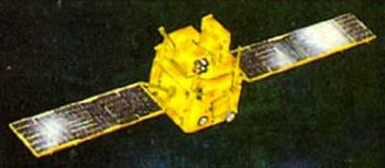 | IRS-1E Credit: Manufacturer Image |
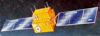 | IRS-P2 Credit: Manufacturer Image |
 | IRS-P3 Credit: Manufacturer Image |
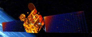 | Kitsat-3 Credit: Manufacturer Image |
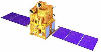 | CartoSat 1 Credit: Manufacturer Image |
 | ResourceSat 1 (IRS-P Credit: Manufacturer Image |
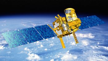 | Megha-Tropique Credit: Manufacturer Image |
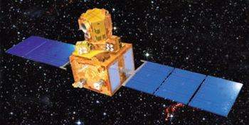 | Resourcesat 2 Credit: Manufacturer Image |
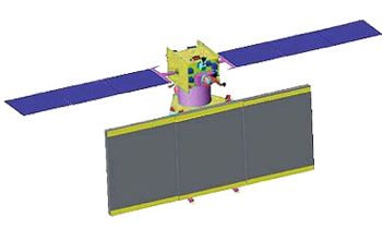 | RISAT-1 Credit: Manufacturer Image |
1988 March 17 - . 06:43 GMT - . Launch Site: Baikonur. Launch Complex: Baikonur LC31. LV Family: R-7. Launch Vehicle: Vostok 8A92M.
- IRS-1A - .
Payload: IRS 1A. Mass: 975 kg (2,149 lb). Nation: India.
Agency: ISRO.
Class: Earth.
Type: Earth resources satellite. Spacecraft: IRS.
USAF Sat Cat: 18960 . COSPAR: 1988-021A. Apogee: 917 km (569 mi). Perigee: 897 km (557 mi). Inclination: 99.00 deg. Period: 103.10 min.
Indian remote sensing; 1st Soviet commercial launch. Indian Remote Sensing Satellite (IRS-1A). Operational remote sensing of the Earth for natural resources management applications. Also registered by the USSR as object no. 2387 in ST/SG/SER.E/182 and orbital parameters 102.7 min, 863 x 917 km x 99.01 deg.
1991 August 29 - . 06:48 GMT - . Launch Site: Baikonur. Launch Complex: Baikonur LC31. LV Family: R-7. Launch Vehicle: Vostok 8A92M.
- IRS-1B - . Payload: IRS 1B. Mass: 980 kg (2,160 lb). Nation: India. Agency: ISRO. Class: Earth. Type: Earth resources satellite. Spacecraft: IRS. USAF Sat Cat: 21688 . COSPAR: 1991-061A. Apogee: 919 km (571 mi). Perigee: 892 km (554 mi). Inclination: 99.00 deg. Period: 103.10 min. Remote sensing; launched commercially by USSR. Operational remote sensing satellite for natural resources management. .
1993 September 20 - . 05:12 GMT - . Launch Site: Sriharikota. Launch Complex: Sriharikota PSLV. Launch Vehicle: PSLV. FAILURE: Software error caused vehicle to go off course.. Failed Stage: G.
- IRS-1E - . Payload: IRS-1E. Mass: 1,250 kg (2,750 lb). Nation: India. Agency: ISRO. Class: Earth. Type: Earth resources satellite. Spacecraft: IRS.
1994 October 15 - . 05:05 GMT - . Launch Site: Sriharikota. Launch Complex: Sriharikota PSLV. Launch Vehicle: PSLV.
- IRS-P2 - . Mass: 870 kg (1,910 lb). Nation: India. Agency: ISRO. Class: Earth. Type: Earth resources satellite. Spacecraft: IRS. USAF Sat Cat: 23323 . COSPAR: 1994-068A. Apogee: 820 km (500 mi). Perigee: 818 km (508 mi). Inclination: 98.67 deg. Period: 101.29 min. Remote sensing; sun-synch orbit..
1995 December 28 - . 06:45 GMT - . Launch Site: Baikonur. Launch Complex: Baikonur LC31. LV Family: R-7. Launch Vehicle: Molniya 8K78M.
- IRS-1C - . Mass: 1,250 kg (2,750 lb). Nation: India. Agency: ISRO. Class: Earth. Type: Earth resources satellite. Spacecraft: IRS. USAF Sat Cat: 23751 . COSPAR: 1995-072A. Apogee: 820 km (500 mi). Perigee: 819 km (508 mi). Inclination: 98.60 deg. Period: 101.30 min. Indian Remote Sensing Satellite..
1996 March 21 - . 04:53 GMT - . Launch Site: Sriharikota. Launch Complex: Sriharikota PSLV. Launch Vehicle: PSLV.
- IRS-P3 - . Mass: 930 kg (2,050 lb). Nation: India. Agency: ISRO. Class: Earth. Type: Earth resources satellite. Spacecraft: IRS. USAF Sat Cat: 23827 . COSPAR: 1996-017A. Apogee: 820 km (500 mi). Perigee: 819 km (508 mi). Inclination: 98.50 deg. Period: 101.30 min. LEO .
1997 September 29 - . 04:47 GMT - . Launch Site: Sriharikota. Launch Complex: Sriharikota PSLV. Launch Vehicle: PSLV.
- IRS-1D - . Payload: IRS-P3. Mass: 1,250 kg (2,750 lb). Nation: India. Agency: ISRO. Class: Earth. Type: Earth resources satellite. Spacecraft: IRS. USAF Sat Cat: 24971 . COSPAR: 1997-057A. Apogee: 823 km (511 mi). Perigee: 742 km (461 mi). Inclination: 98.50 deg. Period: 100.50 min.
1999 May 26 - . 06:22 GMT - . Launch Site: Sriharikota. Launch Complex: Sriharikota PSLV. Launch Vehicle: PSLV.
- OceanSat 1 (IRS-P4) - . Payload: IRS-P4. Mass: 1,036 kg (2,283 lb). Nation: India. Agency: ISRO. Class: Earth. Type: Sea satellite. Spacecraft: IRS. USAF Sat Cat: 25758 . COSPAR: 1999-029C. Apogee: 724 km (449 mi). Perigee: 721 km (448 mi). Inclination: 98.30 deg. Period: 99.30 min. Remote sensing satellite with Ocean Colour Monitor (OCM) and a Multi-frequency Scanning Microwave Radiometer (MSMR).
2001 October 22 - . 04:53 GMT - . Launch Site: Sriharikota. Launch Complex: Sriharikota PSLV. Launch Vehicle: PSLV.
- TES - .
Mass: 1,108 kg (2,442 lb). Nation: India.
Agency: ISRO.
Class: Surveillance.
Type: Military surveillance satellite. Spacecraft Bus: IRS.
Spacecraft: TES.
USAF Sat Cat: 26957 . COSPAR: 2001-049A. Apogee: 592 km (367 mi). Perigee: 533 km (331 mi). Inclination: 97.60 deg. Period: 95.90 min.
Launch delayed from July 20. The PS4 upper stage deployed the 1108 kg Indian TES (Technology Experiment Satellite) into a sun-synchronous orbit at 05:09:10 GMT. TES was an imaging satellite equipped with cameras and instruments to test military reconnaissance satellite technology. It was probably based on the IRS remote sensing satellite and carried a one-meter resolution panchromatic camera. India decided to develop an independent indigenous reconnaissance satellite capability after the 1999 incursion of Pakistani troops into disputed territory in Kashmir caught it by surprise. TES was developed by ISRO, the Indian Space Research Organization.
2003 October 17 - . 04:54 GMT - . Launch Site: Sriharikota. Launch Complex: Sriharikota PSLV. Launch Vehicle: PSLV.
- ResourceSat 1 (IRS-P6) - . Mass: 1,360 kg (2,990 lb). Nation: India. Agency: ISRO. Program: IRS. Class: Earth. Type: Earth resources satellite. Spacecraft: IRS. USAF Sat Cat: 28051 . COSPAR: 2003-046A. Apogee: 836 km (519 mi). Perigee: 813 km (505 mi). Inclination: 98.80 deg. Period: 101.40 min. The satellite was to replace IRS-1C and IRS-1D, and carried three cameras for remote sensing, the highest resolution one being the 6-meter LISS-4 imager. The sensors were designed for agricultural remote sensing applications..
2005 May 5 - . 04:44 GMT - . Launch Site: Sriharikota. Launch Complex: Sriharikota SLP. Launch Vehicle: PSLV.
- CartoSat 1 - .
Payload: IRS-P5. Mass: 1,560 kg (3,430 lb). Nation: India.
Agency: ISRO.
Spacecraft: IRS.
USAF Sat Cat: 28649 . COSPAR: 2005-017A. Apogee: 623 km (387 mi). Perigee: 620 km (380 mi). Inclination: 97.90 deg. Period: 97.10 min.
First launch from new second PSLV pad at Sriharikota. Eleventh satellite in the Indian Remote Sensing satellite series, Cartosat-1 carried two panchromatic cameras, one fore-mounted with a tilt of +26 deg and the other aft-mounted with a tilt of -5 deg from the yaw axis. Together they provided black-and-white stereoscopic pictures in the visible region ( 0.50-0.85 micron) of the electromagnetic spectrum with a spatial resolution of 2.5 metre. The cameras covered a swath of 30 km and a solid state memory recorded up to 120 GB of images for downloading when the satellite passed over the Spacecraft Control Centre at Bangalore or ISTRAC stations at Lucknow, Mauritius, Bears Lake in Russia and Biak in Indonesia. Cartosat 1's sun-synchronous orbit crossed the equator at a local time of 10:30. The spacecraft was 3-axis stabilised using reaction wheels, magnetic torquers and hydrazine thrusters. 1100 W of eectrical power was provided by a 5 sq m solar array and two 24 Ah Ni-Cd batteries. Mission life was 5 years. Launch delayed from February, late April. The multispectral satellite had a 2.5-meter resolution camera.
2007 January 10 - . 04:16 GMT - . Launch Site: Sriharikota. Launch Complex: Sriharikota PSLV. Launch Vehicle: PSLV.
- Cartosat-2 - .
Mass: 680 kg (1,490 lb). Nation: India.
Agency: ISRO.
Class: Surveillance.
Type: Civilian surveillance satellite. Spacecraft: IRS.
USAF Sat Cat: 29710 . COSPAR: 2007-001B. Apogee: 644 km (400 mi). Perigee: 629 km (390 mi). Inclination: 98.00 deg. Period: 97.40 min.
The satellite was the twelfth in the Indian Remote Sensing satellite series and was capable of providing scene-specific spot imagery. The panchromatic camera provided imagery with a spatial resolution of better than one metre and a swath of 9.6 km. Data from the satellite was to be used for detailed mapping.
2008 April 28 - . 03:53 GMT - . Launch Site: Sriharikota. Launch Complex: Sriharikota SLP. Launch Vehicle: PSLV.
- Cartosat 2A - . Mass: 768 kg (1,693 lb). Nation: India. Agency: ISRO. Class: Surveillance. Type: Military Radarsat. Spacecraft: IRS. USAF Sat Cat: 32783 . COSPAR: 2008-021A. Apogee: 645 km (400 mi). Perigee: 623 km (387 mi). Inclination: 98.00 deg. Period: 97.40 min. Primary payload, an imaging satellite with a spatial resolution of better than one metre and a swath of 9.6 km. Data from the satellite was to be used for detailed mapping..
2009 September 23 - . 06:21 GMT - . Launch Site: Sriharikota. Launch Complex: Sriharikota PSLV. Launch Vehicle: PSLV.
- Oceansat-2 - . Mass: 1,000 kg (2,200 lb). Nation: India. Agency: ISRO. Class: Surveillance. Type: Surveillance satellite. Spacecraft Bus: IRS. Spacecraft: Oceansat. USAF Sat Cat: 35931 . COSPAR: 2009-051A. Apogee: 726 km (451 mi). Perigee: 720 km (440 mi). Inclination: 98.30 deg. Period: 99.20 min. Remote sensing satellite with an 8-band ocean color monitor, a radar scatterometer and a radio occultation atmospheric sounder..
2010 July 12 - . 03:52 GMT - . Launch Site: Sriharikota. Launch Complex: Sriharikota PSLV. Launch Vehicle: PSLV.
- Cartosat 2B - . Mass: 694 kg (1,530 lb). Nation: India. Agency: ISRO. Class: Surveillance. Type: Cartographic satellite. Spacecraft: IRS. USAF Sat Cat: 36795 . COSPAR: 2010-035A. Apogee: 647 km (402 mi). Perigee: 629 km (390 mi). Inclination: 98.10 deg. Period: 97.50 min. Cartography satellite with 0.8 meter resolution..
2011 April 20 - . 04:42 GMT - . Launch Site: Sriharikota. Launch Complex: Sriharikota PSLV. Launch Vehicle: PSLV.
- Resourcesat 2 - .
Mass: 1,200 kg (2,600 lb). Nation: India.
Program: IRS.
Class: Surveillance.
Type: Military surveillance satellite. Spacecraft: IRS.
USAF Sat Cat: 37387 . COSPAR: 2011-015A. Apogee: 825 km (512 mi). Perigee: 820 km (500 mi). Inclination: 98.80 deg. Period: 101.30 min.
Surveillance satellite. Carried the LISS-4 camera, a 6-meter-resolution imager, which was to be used for both military reconnaissance and civilian remote sensing. It also carried the lower resolution LISS-3 (23 m resolution) and AWIFS (56 m resolution), and an AIS Automatic Identification System payload for Comdev of Canada for tracking ships at sea.
2011 October 12 - . 05:31 GMT - . Launch Site: Sriharikota. Launch Complex: Sriharikota PSLV. Launch Vehicle: PSLV.
- Megha-Tropique - . Mass: 1,000 kg (2,200 lb). Nation: India. Class: Earth. Type: Earth resources satellite. Spacecraft: IRS. USAF Sat Cat: 37838 . COSPAR: 2011-058A. Apogee: 868 km (539 mi). Perigee: 853 km (530 mi). Inclination: 20.00 deg. Period: 102.20 min. Joint Indian-French remote sensing satellite; carried a MADRAS microwave imager, a Saphir water vapor profile instrument, and a ScaRaB radiation budget scanner..
2012 April 26 - . 00:17 GMT - . Launch Site: Sriharikota. Launch Complex: Sriharikota PSLV. LV Family: PSLV. Launch Vehicle: PSLV-XL.
- RISAT-1 - . Mass: 1,858 kg (4,096 lb). Nation: India. Class: Surveillance. Type: Civilian Radarsat. Spacecraft: IRS. USAF Sat Cat: 38248 . COSPAR: 2012-017A. Apogee: 550 km (340 mi). Perigee: 529 km (328 mi). Inclination: 97.60 deg. Period: 95.40 min. Radar Imaging Satellite with a C-band synthetic aperture radar payload mounted on an IRS- derived bus..
Back to top of page
Home - Search - Browse - Alphabetic Index: 0- 1- 2- 3- 4- 5- 6- 7- 8- 9
A- B- C- D- E- F- G- H- I- J- K- L- M- N- O- P- Q- R- S- T- U- V- W- X- Y- Z
© 1997-2019 Mark Wade - Contact
© / Conditions for Use