Home - Search - Browse - Alphabetic Index: 0- 1- 2- 3- 4- 5- 6- 7- 8- 9
A- B- C- D- E- F- G- H- I- J- K- L- M- N- O- P- Q- R- S- T- U- V- W- X- Y- Z
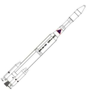
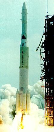
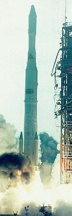
Thor Delta M
 Delta M6 Credit: © Thomas Kladiva - Thomas Kladiva |
AKA: Delta M;Long Tank Thor. Status: Retired 1971. First Launch: 1968-09-19. Last Launch: 1971-02-03. Number: 12 . Payload: 355 kg (782 lb). Thrust: 2,140.70 kN (481,249 lbf). Gross mass: 103,681 kg (228,577 lb). Height: 34.00 m (111.00 ft). Diameter: 2.44 m (8.00 ft). Apogee: 40,000 km (24,000 mi).
LEO Payload: 355 kg (782 lb). Payload: 355 kg (782 lb) to a GTO. Flyaway Unit Cost 1985$: 22.300 million.
Stage Data - Delta M
- Stage 0. 6 x Castor 2. Gross Mass: 4,424 kg (9,753 lb). Empty Mass: 695 kg (1,532 lb). Thrust (vac): 258.915 kN (58,206 lbf). Isp: 262 sec. Burn time: 37 sec. Isp(sl): 232 sec. Diameter: 0.79 m (2.59 ft). Span: 0.79 m (2.59 ft). Length: 6.04 m (19.81 ft). Propellants: Solid. No Engines: 1. Engine: TX-354-3. Status: In Production.
- Stage 1. 1 x Delta Thor LT. Gross Mass: 70,354 kg (155,104 lb). Empty Mass: 3,715 kg (8,190 lb). Thrust (vac): 866.710 kN (194,844 lbf). Isp: 290 sec. Burn time: 215 sec. Isp(sl): 256 sec. Diameter: 2.44 m (8.00 ft). Span: 2.44 m (8.00 ft). Length: 21.43 m (70.30 ft). Propellants: Lox/Kerosene. No Engines: 1. Engine: MB-3-3. Other designations: Long Tank Thor. Status: Out of Production.
- Stage 2. 1 x Delta E. Gross Mass: 6,009 kg (13,247 lb). Empty Mass: 785 kg (1,730 lb). Thrust (vac): 35.098 kN (7,890 lbf). Isp: 278 sec. Burn time: 400 sec. Diameter: 1.40 m (4.50 ft). Span: 1.40 m (4.50 ft). Length: 6.28 m (20.60 ft). Propellants: Nitric acid/UDMH. No Engines: 1. Engine: AJ10-118E. Status: Out of Production.
- Stage 3. 1 x Burner 2. Gross Mass: 774 kg (1,706 lb). Empty Mass: 116 kg (255 lb). Thrust (vac): 43.551 kN (9,791 lbf). Isp: 285 sec. Burn time: 42 sec. Isp(sl): 220 sec. Diameter: 0.66 m (2.16 ft). Span: 0.66 m (2.16 ft). Length: 0.84 m (2.75 ft). Propellants: Solid. No Engines: 1. Engine: Star 37. Status: Out of Production. Burner II was a launch vehicle upper stage developed by Boeing for the Air Force Space Systems Division. It was the first solid-fuel upper stage with full control and guidance capability developed for general space applications. Burner II was designed for use with the Thor booster, but was readily adapted for use on the complete range of standard launch vehicles. Its general assignment was to place small- and medium size payloads into orbit. The Burner II motor, guidance system and reaction control system were integrated to provide attitude stability and precise control of flight rate and burnout velocity for orbital injection and earth-escape missions. Boeing had delivered 8 flight vehicles under its original contract. Under terms of a follow-on contract, it built 6 additional flight models. Four Thor-Burner II combinations were launched successfully from Vandenberg Air Force Base, California. The third launch placed 2 unclassified satellites in Earth orbit. A SECOR satellite, built for the U.S. Army Corps of Engineers by the Cubic Corporation, and an Aurora satellite, developed by Rice University for the Office of Naval Research, were placed in circular orbits 3,300 km above the Earth. As integration contractor for the Air Force Space Experiment Support Program (SESP) Office, Boeing designed, built and tested the injection stage, or "payload dispenser," which carried the 2 satellites on top of a standard Burner II stage and placed them in precise orbits. The satellites were mounted on opposite sides of the injection stage, which housed a640 kgf thrust, solid-propellant rocket motor. The Burner II was used as an upper stage by NASA for deep space probes. Prime Contractor: The Boeing Company. Major Subcontractors Thiokol Chemical Corporation (solid rocket motor); Honeywell Inc. (pre-programmed inertial guidance system); Walter Kidde Co. (reaction control system).
Family: orbital launch vehicle. Country: USA. Engines: AJ10-118E, MB-3-3. Spacecraft: IMP, Intelsat 3, NATO 1, Skynet. Projects: Intelsat. Launch Sites: Cape Canaveral, Cape Canaveral LC17A. Stages: Delta Thor LT, Delta E, Castor 2, Star 37D, Star 37. Agency: NATO, Douglas.
 | Delta M6 no. 83 Delta M6 no. 83 - COSPAR 1971-019 |
 | Delta M no. 80 Delta M no. 80 - COSPAR 1970-062 |
1968 September 19 - . 00:09 GMT - . Launch Site: Cape Canaveral. Launch Complex: Cape Canaveral LC17A. LV Family: Thor. Launch Vehicle: Thor Delta M. FAILURE: Control system failure; destroyed by range safety.. Failed Stage: G.
- Intelsat-3 F-1 - . Mass: 293 kg (645 lb). Nation: International. Agency: Intelsat. Program: Intelsat. Class: Communications. Type: Civilian communications satellite. Spacecraft: Intelsat 3. Decay Date: 1968-09-18 .
1968 December 19 - . 00:32 GMT - . Launch Site: Cape Canaveral. Launch Complex: Cape Canaveral LC17A. LV Family: Thor. Launch Vehicle: Thor Delta M.
- Intelsat 3 F-2 - .
Mass: 293 kg (645 lb). Nation: International.
Agency: INTELSAT.
Program: Intelsat.
Class: Communications.
Type: Civilian communications satellite. Spacecraft: Intelsat 3.
Completed Operations Date: 1977-01-25 . USAF Sat Cat: 3623 . COSPAR: 1968-116A. Apogee: 37,111 km (23,059 mi). Perigee: 35,984 km (22,359 mi). Inclination: 15.10 deg. Period: 1,475.20 min.
Over Brazil. Spacecraft engaged in practical applications and uses of space technology such as weather or communication (US Cat C). Positioned in geosynchronous orbit over the Atlantic Ocean at 24 deg W in 1969-1970. As of 3 September 2001 located at 96.04 deg E drifting at 9.557 deg W per day. As of 2007 Mar 9 located at 48.04W drifting at 9.553W degrees per day.
1969 February 6 - . 00:39 GMT - . Launch Site: Cape Canaveral. Launch Complex: Cape Canaveral LC17A. LV Family: Thor. Launch Vehicle: Thor Delta M.
- Intelsat 3 F-3 - .
Mass: 293 kg (645 lb). Nation: International.
Agency: INTELSAT.
Program: Intelsat.
Class: Communications.
Type: Civilian communications satellite. Spacecraft: Intelsat 3.
Completed Operations Date: 1979-12-13 . USAF Sat Cat: 3674 . COSPAR: 1969-011A. Apogee: 35,803 km (22,246 mi). Perigee: 35,767 km (22,224 mi). Inclination: 6.10 deg. Period: 1,436.00 min.
Stationed at 63 deg E. Spacecraft engaged in practical applications and uses of space technology such as weather or communication (US Cat C). Positioned in geosynchronous orbit over the Pacific Ocean at 174 deg E in 1969; over the Indian Ocean 062 deg E in 1969-1975. Last known longitude (24 May 1979) 66.72 deg E drifting at 0.017 deg E per day.
1969 May 22 - . 02:00 GMT - . Launch Site: Cape Canaveral. Launch Complex: Cape Canaveral LC17A. LV Family: Thor. Launch Vehicle: Thor Delta M.
- Intelsat 3 F-4 - .
Mass: 293 kg (645 lb). Nation: International.
Agency: INTELSAT.
Program: Intelsat.
Class: Communications.
Type: Civilian communications satellite. Spacecraft: Intelsat 3.
Completed Operations Date: 1977-05-13 . USAF Sat Cat: 3947 . COSPAR: 1969-045A. Apogee: 39,752 km (24,700 mi). Perigee: 39,486 km (24,535 mi). Inclination: 6.10 deg. Period: 1,636.30 min.
Positioned in geosynchronous orbit over the Pacific Ocean at 175 deg E in 1969-1972; ? 1972-1977; over the Pacific Ocean 166 deg W in 1977. Last known longitude (20 May 1977) 161.73 deg E drifting at 44.175 deg W per day.Spacecraft engaged in practical applications and uses of space technology such as weather or communication (US Cat C).
1969 July 26 - . 02:06 GMT - . Launch Site: Cape Canaveral. Launch Complex: Cape Canaveral LC17A. LV Family: Thor. Launch Vehicle: Thor Delta M. FAILURE: Third stage failure; left in unusable orbit.. Failed Stage: 3.
- Intelsat 3 F-5 - . Mass: 269 kg (593 lb). Nation: International. Agency: INTELSAT. Program: Intelsat. Class: Communications. Type: Civilian communications satellite. Spacecraft: Intelsat 3. Decay Date: 1988-10-14 . USAF Sat Cat: 4051 . COSPAR: 1969-064A. Apogee: 433 km (269 mi). Perigee: 211 km (131 mi). Inclination: 30.20 deg. Period: 91.00 min. Third stage failure; left in unusable orbit. Spacecraft engaged in practical applications and uses of space technology such as weather or communication (US Cat C)..
1969 November 22 - . 00:37 GMT - . Launch Site: Cape Canaveral. Launch Complex: Cape Canaveral LC17A. LV Family: Thor. Launch Vehicle: Thor Delta M.
- Skynet 1A - .
Mass: 243 kg (535 lb). Nation: UK.
Agency: MoD.
Program: Skynet.
Class: Communications.
Type: Military communications satellite. Spacecraft Bus: Skynet.
Spacecraft: NATO 1.
Completed Operations Date: 1980-01-01 . USAF Sat Cat: 4250 . COSPAR: 1969-101A. Apogee: 35,894 km (22,303 mi). Perigee: 35,682 km (22,171 mi). Inclination: 13.90 deg. Period: 1,436.20 min.
Skynet IA, the first of two Skynet military communications satellite built for the United Kingdom by the Philco-Ford Corporation, was launched from Cape Canaveral aboard a NASA Long Tank Thrust Augmented Thor/Delta (DSV-3L). The satellite was turned over to the United Kingdom on 30 January 1970, providing the United Kingdom with its first operational military communications satellite system. The Skynet satellites were designed to be usable with the Initial Defense Satellite Communication System (IDSCS) satellites of the United States. Over Indian Ocean. Military communications. Previously registered by the United States in A/AC.105/INF.220: 1969-101A, orbital data 276 x 36716 km x 28.0 deg, category C. Positioned in geosynchronous orbit over the Indian Ocean at 41 deg E in 1969-1972?; ??? 1972-1977; over the Americas at 100-110 deg W in 1977-1998 As of 26 August 2001 located at 104.51 deg W drifting at 0.015 deg W per day. As of 2007 Mar 9 located at 106.94W drifting at 0.015W degrees per day.
1970 January 15 - . 00:16 GMT - . Launch Site: Cape Canaveral. Launch Complex: Cape Canaveral LC17A. LV Family: Thor. Launch Vehicle: Thor Delta M.
- Intelsat 3 F-6 - .
Mass: 293 kg (645 lb). Nation: International.
Agency: INTELSAT.
Program: Intelsat.
Class: Communications.
Type: Civilian communications satellite. Spacecraft: Intelsat 3.
Completed Operations Date: 1977-05-13 . USAF Sat Cat: 4297 . COSPAR: 1970-003A. Apogee: 36,126 km (22,447 mi). Perigee: 36,079 km (22,418 mi). Inclination: 14.30 deg. Period: 1,452.30 min.
Stationed at 336 deg E. Spacecraft engaged in practical applications and uses of space technology such as weather or communication (US Cat C). Positioned in geosynchronous orbit over the Atlantic Ocean at 25 deg W in 1970; over the Atlantic Ocean 30 deg W in 1970-1971; over the Atlantic Ocean 20 deg W in 1971 Apr-1972 Mar; over the Indian Ocean 64 deg E in 1972-1974; over the Pacific Ocean 177 deg W in 1975 As of 5 September 2001 located at 163.49 deg E drifting at 4.024 deg W per day. As of 2007 Feb 27 located at 47.49E drifting at 4.027W degrees per day.
1970 March 20 - . 23:52 GMT - . Launch Site: Cape Canaveral. Launch Complex: Cape Canaveral LC17A. LV Family: Thor. Launch Vehicle: Thor Delta M.
- NATO 1 - .
Payload: NATO IIA. Mass: 243 kg (535 lb). Nation: NATO.
Agency: NATO.
Program: NATO.
Class: Communications.
Type: Military communications satellite. Spacecraft Bus: Skynet.
Spacecraft: NATO 1.
Completed Operations Date: 1977-01-01 . USAF Sat Cat: 4353 . COSPAR: 1970-021A. Apogee: 35,801 km (22,245 mi). Perigee: 35,768 km (22,225 mi). Inclination: 13.40 deg. Period: 1,436.00 min.
The first of two communications satellites built for the North Atlantic Treaty Organization (NATO) by the Philco-Ford Corporation under a SAMSO contract was launched from Cape Canaveral aboard a NASA Long Tank Thrust Augmented Thor/ Delta booster. Inserted into synchronous orbit on 23 March, the satellite was turned over to the Supreme Headquarters Allied Forces Europe (SHAFE) on 19 May. Spacecraft engaged in practical applications and uses of space technology such as weather or communication (US Cat C). Positioned in geosynchronous orbit over the Atlantic Ocean at 18 deg W in 1970-1972; over the Americas at 100-110 deg W in 1977-1998 As of 3 September 2001 located at 101.97 deg W drifting at 0.023 deg E per day. As of 2007 Mar 9 located at 100.55W drifting at 0.016W degrees per day.
1970 April 23 - . 00:46 GMT - . Launch Site: Cape Canaveral. Launch Complex: Cape Canaveral LC17A. LV Family: Thor. Launch Vehicle: Thor Delta M.
- Intelsat 3 F-7 - .
Mass: 293 kg (645 lb). Nation: International.
Agency: INTELSAT.
Program: Intelsat.
Class: Communications.
Type: Civilian communications satellite. Spacecraft: Intelsat 3.
Completed Operations Date: 1972-05-01 . USAF Sat Cat: 4376 . COSPAR: 1970-032A. Apogee: 35,791 km (22,239 mi). Perigee: 35,775 km (22,229 mi). Inclination: 0.90 deg. Period: 1,435.90 min.
Stationed at 341 deg E. Positioned in geosynchronous orbit over the Atlantic Ocean at 19 deg W in 1970-1971 Last known longitude (1 January 1972) L 139.45 deg E drifting at 0.022 deg E per day. Spacecraft engaged in practical applications and uses of space technology such as weather or communication (US Cat C).
1970 July 23 - . 23:23 GMT - . Launch Site: Cape Canaveral. Launch Complex: Cape Canaveral LC17A. LV Family: Thor. Launch Vehicle: Thor Delta M.
- Intelsat 3 F-8 - .
Mass: 270 kg (590 lb). Nation: International.
Agency: INTELSAT.
Program: Intelsat.
Class: Communications.
Type: Civilian communications satellite. Spacecraft: Intelsat 3.
Completed Operations Date: 1970-07-25 . USAF Sat Cat: 4478 . COSPAR: 1970-055A. Apogee: 36,599 km (22,741 mi). Perigee: 33,877 km (21,050 mi). Inclination: 12.10 deg. Period: 1,408.20 min.
Unusable orbit. Spacecraft engaged in practical applications and uses of space technology such as weather or communication (US Cat C). As of 28 August 2001 located at 175.58 deg E drifting at 7.155 deg E per day. As of 2007 Mar 9 located at 110.93W drifting at 7.169E degrees per day.
1970 August 19 - . 12:11 GMT - . Launch Site: Cape Canaveral. Launch Complex: Cape Canaveral LC17A. LV Family: Thor. Launch Vehicle: Thor Delta M.
- Skynet 1B - .
Mass: 243 kg (535 lb). Nation: UK.
Agency: MoD.
Program: Skynet.
Class: Communications.
Type: Military communications satellite. Spacecraft Bus: Skynet.
Spacecraft: NATO 1.
USAF Sat Cat: 4493 . COSPAR: 1970-062A. Apogee: 37,460 km (23,270 mi). Perigee: 278 km (172 mi). Inclination: 25.90 deg. Period: 665.40 min.
The second of two British Skynet I communication satellites (Skynet B) was launched from Cape Canaveral for U.S. Air Force and United Kingdom aboard a NASA Long Tank Thrust Augmented Thor/ Delta (DSV-3M) space booster. The spacecraft was placed in a transfer orbit prior to firing of the apogee kick motor that was to put it into a synchronous orbit over Kenya. Contact with Skynet B was lost during the firing of the apogee kick motor on 22 August and was not regained. The Skynet I satellites were part of the Initial Defense Satellite Communication System (TDSCS) program which was managed for the United Kingdom by SAMSO, with NASA providing launch vehicles and services. AKM failure left in unusable orbit. Spacecraft engaged in practical applications and uses of space technology such as weather or communication (US Cat C).
1971 February 3 - . 01:41 GMT - . Launch Site: Cape Canaveral. Launch Complex: Cape Canaveral LC17A. LV Family: Thor. Launch Vehicle: Thor Delta M.
- NATO 2 - .
Payload: NATO IIB. Mass: 243 kg (535 lb). Nation: NATO.
Agency: NATO.
Program: NATO.
Class: Communications.
Type: Military communications satellite. Spacecraft Bus: Skynet.
Spacecraft: NATO 1.
Completed Operations Date: 1984-06-01 . USAF Sat Cat: 4902 . COSPAR: 1971-009A. Apogee: 35,802 km (22,246 mi). Perigee: 35,772 km (22,227 mi). Inclination: 13.90 deg. Period: 1,436.10 min.
The second NATO military communications satellite (NATO IIB) was launched by NASA aboard a Thrust Augmented Thor/Delta booster. Developed for NATO under SAMSO program management, the spacecraft was first placed in a transfer orbit and then moved into an acceptable synchronous orbit on 4 February. Although numerous difficulties were experienced prior to launch, the satellite achieved its stationary orbit and has performed successfully since then. Spacecraft engaged in practical applications and uses of space technology such as weather or communication (US Cat C). Positioned in geosynchronous orbit over the Atlantic Ocean at 26 deg W in 1971-1975?; over the Americas at 105 deg W in 1976-1983; over the Americas at 110 deg W in 1983; over the Americas at 105 deg W in 1983-1998 As of 5 September 2001 located at 104.88 deg W drifting at 0.004 deg W per day. As of 2007 Mar 9 located at 105.24W drifting at 0.007W degrees per day.
Back to top of page
Home - Search - Browse - Alphabetic Index: 0- 1- 2- 3- 4- 5- 6- 7- 8- 9
A- B- C- D- E- F- G- H- I- J- K- L- M- N- O- P- Q- R- S- T- U- V- W- X- Y- Z
© 1997-2019 Mark Wade - Contact
© / Conditions for Use